
 Français
 Nederlands
 Deutsch


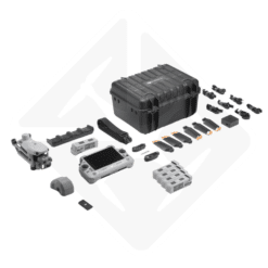
DJI Matrix 4E + RTK Surveying Pack
€ 7.499,00
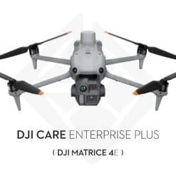
DJI Care Enterprise Plus 1 year included: renewable twice (up to 3 years of coverage)
Complete topography pack around the DJI Matrice 4E: drone with built-in RTK, 5 batteries, Cellular Dongle 2 for NTRIP correction, D-RTK 3 base station and DJI Terra Online 1-year license. Turnkey solution for cadastral surveys, site monitoring and photogrammetry in Wallonia and Flanders. Price on estimate.
In stock
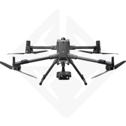
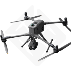
DJI Matrix 4E Surveying Package: the complete solution for your surveys in Belgium
The DJI Matrix 4E Surveying Pack brings together all the equipment needed to carry out centimeter-accurate photogrammetric surveys. Designed for surveyors, planners, real estate experts and construction contractors, this package covers up to 2.8 km² per flight thanks to the M4E’s ortho-tridirectional capture. It is a turnkey solution, ready to deploy in the field upon receipt.
In Belgium, the RTK correction networks Walcors (Wallonia) and Flepos (Flanders) are accessible free of charge. The Cellular Dongle 2 included in this pack connects the Matrice 4E to these networks via 4G. The result: direct georeferencing without ground control points (GCPs) for most missions.
Surveying + RTK Pack or Photogrammetry Pack: which one should you choose?
This Surveying Pack adds a D-RTK 3 Multifunctional Station and a D-RTK 3 mast/tripod kit to the DJI Matrice 4E, guaranteeing centimeter-level autonomous RTK accuracy even without mobile network coverage. The DJI Matrice 4E Photogrammetry Pack instead offers 4 additional batteries and 4G connectivity, for general mapping, inspection and surveillance missions without an autonomous RTK base station.
Surveyors, design offices and construction contractors: this Surveying Pack is the reference choice for cadastral surveys and precision measurements. For more general mapping needs, the Photogrammetry Pack is a lighter alternative.
Detailed contents of the DJI Matrice 4E Surveying Pack
| Component | Detail |
|---|---|
| DJI Matrix 4E | Drone with built-in RTK + 1 battery + RC Remote Control Plus 2 + DJI Terra Online license 1 year |
| 4 additional DJI Matrice 4 Series | 5 batteries in total for a full day of readings (unit autonomy: 49 min) |
| DJI Cellular Dongle 2 | 4G connectivity for RTK correction via NTRIP (Walcors / Flepos) |
| D-RTK 3 Multifunctional Station | RTK base station for areas without mobile network coverage |
| D-RTK 3 Survey Pole and Tripod Kit | Mast and tripod for quick installation of the RTK base in the field |
Thanks to this configuration, you have both a wireless NTRIP solution and a stand-alone base station as a backup. This dual approach ensures the continuity of your operations, even in rural areas with poor 4G coverage.
Matrice 4E multi-camera system
The DJI Matrice 4E has three complementary cameras. The wide-angle camera uses a 20 MP 4/3-inch sensor with a mechanical shutter. This shutter eliminates rolling shutter distortion, which is essential for sharp images in fast flight. In addition, the built-in distortion correction (Distortion Correction 2.0) improves the geometric fidelity of the shots.
The medium tele camera (1/1.3-inch sensor, 48 MP, 70 mm equivalent) and the telephoto camera (1/1.5-inch sensor, 48 MP, 168 mm equivalent) complete the system. In particular, they allow the close inspection of details during site inspection or roof inspection missions.
The built-in laser rangefinder provides a range of 1,800 m with an accuracy of ± (0.2 + 0.0015 × D) meter. It makes it easy to measure distances, surfaces, and position points of interest directly from the DJI Pilot 2 app.
Centimeter RTK accuracy
The RTK module built into the Matrice 4E supports GPS, Galileo, BeiDou and GLONASS constellations (the latter when RTK is enabled). In RTK Fix mode, the accuracy reaches 1 cm + 1 ppm horizontal and 1.5 cm + 1 ppm vertical. For surveying and mapping, this accuracy eliminates the need for Ground Control Points (GCPs) with the wide-angle camera, significantly speeding up the field workflow.
Missions covered by this drone topography pack
- Cadastral surveys and measurements of plots in Wallonia and Flanders
- Site monitoring: cubature calculations, contour lines, cross sections
- Digital Surface Models (DSM) and Digital Elevation Models (DTM)
- High-resolution ortho-mosaics for urban plans and planning permits
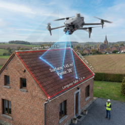
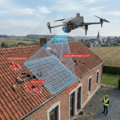
- Roof inspections as part of real estate appraisals
- Mapping of quarries, landfills, agricultural sites and industrial areas
4-step photogrammetric workflow
The workflow with the DJI Matrice 4E Surveying Pack is simple and efficient. Each step is optimized to reduce time spent in the field and in post-processing.
- Planning in DJI Pilot 2: Set the flight area, altitude, and overlap rate (75-80% recommended). The RC Remote Control Plus 2 allows you to create 3D flight plans directly in the field, without a laptop.
- Automated flight: The M4E executes the flight plan with real-time RTK positioning. Omnidirectional obstacle avoidance makes missions safer even in complex environments (construction sites, wooded areas, urban environments).
- Processing in DJI Terra: Generate ortho-mosaics, point clouds, DSMs, and terrains. The software supports advanced M4E-specific distortion correction and offline PPK processing of images.
- Export: The data is compatible with AutoCAD, QGIS, ArcGIS, Agisoft Metashape, and other common GIS software.
Free RTK networks in Belgium: Walcors and Flepos
Belgium offers a major advantage to drone surveying professionals: two free RTK correction networks cover the entire territory. Walcors is managed by the SPW in Wallonia, while Flepos is operated by Digitaal Vlaanderen in Flanders. The Cellular Dongle 2 in the pack connects the drone to these networks in real time via 4G, without an additional subscription.
For areas with poor mobile coverage, the D-RTK 3 Multifunctional Station takes over. It provides local RTK corrections and can also serve as a video transmission relay at altitude, a feature exclusive to the Matrice 4 series.
Key Features of DJI Matrice 4E
| Characteristic | Value |
|---|---|
| Take-off | 1,219 g (with standard propellers) |
| Flight | Up to 49 minutes |
| Wide-angle | 4/3″ sensor, 20 MP, mechanical shutter, f/2.8-f/11 |
| Medium TV Camera | 1/1.3″ sensor, 48 MP, eq. 70 mm |
| Telephoto camera | 1/1.5″ sensor, 48 MP, eq. 168 mm |
| RTK Fix | 1 cm + 1 ppm (H) / 1.5 cm + 1 ppm (V) |
| Laser | Range 1,800 m |
| avoidance | Omnidirectional (binocular vision + 3D IR sensor) |
| Wind | Up to 12 m/s |
| Coverage per flight | Up to 2.8 km² in mapping mode |
Data and deliverables for surveying firms
With its built-in RTK module, this pack delivers RTK Fix accuracy of 1 cm + 1 ppm horizontal and 1.5 cm + 1 ppm vertical, without ground control points (GCPs) for most missions.
Processing in DJI Terra generates orthophotos and digital surface models (DSM) exported in GeoTIFF format (UTM projection), as well as point clouds exportable in LAS format. These deliverables are compatible with AutoCAD, QGIS, ArcGIS and Agisoft Metashape.
Drone regulations and EASA category
With a take-off weight of 1,219 g, the DJI Matrice 4E exceeds the threshold of 900 g in the Open A1 subcategory. Depending on the class marking of the device, it may operate in subcategory A2 or require authorization in category Specific. In Belgium, the DGTA (Directorate-General for Air Transport) manages authorisations. For routine topography missions in open areas, the regulatory framework remains accessible. We accompany you in the steps if necessary.
Additional Services Drone Parts Center
As a Authorized DJI Enterprise Dealer in Belgium, we offer services that ideally complement this DJI Matrix 4E Surveying Package:
- DJI Care Enterprise Plus M4E: Crash or Damage Replacement Insurance
- 2-year Zen pack: regular preventive maintenance in our workshop in Nivelles
- Drone photogrammetry training : 1 day of theory and field practice to master the complete workflow
Are you a surveyor, design office or construction contractor? Request your personalized quote for this DJI Matrix 4E topography pack or contact us at +32 67 88 37 37. We deliver everywhere in Belgium and the Benelux.
Protect your investment
Your DJI Matrice 4E is a working tool. Drone Parts Center, Authorized DJI Enterprise Dealer for the Benelux, offers the official DJI services and safety equipment suited to your platform:
Your drone ships with 1 year of DJI Care Enterprise Plus. Remember to extend this protection before it ends: renewal must take place before expiry or within the following 15 days.
- DJI Care Enterprise Plus renewal (DJI Matrice 4E): extend the coverage included with your drone. Free repair or replacement within the coverage limit, no deductible, round-trip shipping covered by DJI. Renewable up to 3 consecutive years in total.
- DJI Maintenance Standard (DJI Matrice 4E): detailed 8-point inspection, deep cleaning, full update and calibration, replacement of commonly worn parts (shell, propellers, landing gear, antenna, screws), official DJI maintenance report. The Basic and Premium plans are detailed in the comparison table.
- Dronavia Kronos M4 parachute: EASA-compliant class C5 conversion kit (MoC M2 + MoC 2511) with integrated FTS, enabling STS-01 standard scenario operations, including over populated areas or near uninvolved persons.
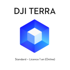
- DJI Terra Standard license (1 year): 2D and 3D reconstruction of your datasets for surveying and photogrammetry.
Discover the complete solution: Site progress monitoring by drone
Only logged in customers who have purchased this product may leave a review.


Related products


Building and infrastructure inspection
Available to order: contact us for lead time.
Building and infrastructure inspection
DJI Matrice 4E Drone – Special Package for Measuring and Inspecting Roofs
In stock


Building and infrastructure inspection
Available to order: contact us for lead time.

Building and infrastructure inspection
Available to order: contact us for lead time.
Building and infrastructure inspection
In stock

Reviews
There are no reviews yet.