
 Français
 Nederlands
 Deutsch


DJI Terra – Standard – 1 Year License (Online)
€ 1.860,00
DJI Terra Standard (1-year license, Online version) is DJI’s photogrammetry and mapping software. It generates 2D maps, 3D models, and LiDAR point clouds. Compatible with DJI Enterprise drones, it incorporates multispectral reconstruction for precision agriculture. Updates included for 12 months.
In stock
DJI Terra Standard: The Mapping Software for Professional Drones
The DJI Terra Standard 1-Year (Online) license transforms the data captured by your DJI drones into accurate 2D maps and actionable 3D models. This photogrammetry software is aimed at surveyors, engineers and aerial mapping professionals who are looking for a reliable and efficient tool.
Developed by DJI, Terra Standard offers a unified ecosystem for the acquisition, processing, and exploitation of field data. With this annual license, you get 12 months of full access to essential features, including software updates.
High-precision 2D and 3D photogrammetry
DJI Terra Standard quickly generates digital orthophotos (TDOM), digital surface models (DSM), and detailed 3D models from your aerial images. The optimized algorithms make it possible to achieve professional mapping standards.
The data processing is carried out locally on your computer. This ensures full control over your projects and optimal privacy of your sensitive data. The results are exported in standard formats: TIFF, LAS, and OBJ.
Supported output formats
- Real Digital Orthophotos (TDOM) for Precision Mapping
- Digital Surface Models (DSMs) for Topographic Analysis
- Mesh 3D Models for Building and Infrastructure Reconstruction
- Dense point clouds for volumetric modeling
Built-in LiDAR processing for accurate point clouds
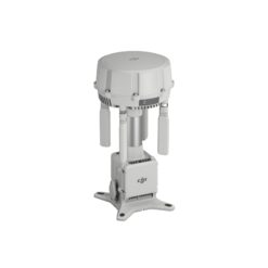
DJI Terra Standard supports data collected by DJI’s Zenmuse LiDAR sensors, including the latest Zenmuse L3. The software merges LiDAR data and visible-light images to simultaneously produce point clouds, 2D maps, and 3D models.
This deep integration between sensor and software simplifies the workflow. A single acquisition with the Zenmuse LiDAR is enough to generate all the cartographic deliverables necessary for your inspection or surveying projects.
Multispectral reconstruction for agriculture
Using multispectral data from the DJI Mavic 3 Multispectral, DJI Terra Standard produces NDVI and NDRE vegetation index maps. These analyses offer actionable insights into crop health and growth.
The software also supports radiometric correction and the creation of reflectance maps. These features meet the requirements of researchers and agronomists specializing in agricultural remote sensing.
Main agricultural applications
- NDVI and NDRE vegetation index maps
- Radiometric correction for remote sensing research
- Reflectance maps for field tracking
- Crop health analysis and early detection of plant stress
Hardware compatibility with the DJI Enterprise ecosystem
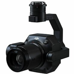
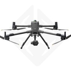
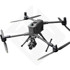
DJI Terra Standard works with leading DJI Enterprise drones and sensors. Combined with the DJI Matrice 4E, Matrice 400, Zenmuse P1, Zenmuse L3 and D-RTK 3, it delivers complete visible light and LiDAR mapping solutions.
This hardware and software synergy eliminates compatibility issues. You work in an integrated ecosystem, from mission planning to the final deliverable.
Online License: Simple activation and continuous updates
The online version of DJI Terra Standard requires an internet connection for license verification. Each license is linked to a DJI Account and a single computer. In the event of a change of position, a request for delinking is possible once per calendar year.
After activation, the software remains usable offline for a maximum of 3 consecutive days. This flexibility is suitable for occasional field interventions without network access.
Technical requirements
- Operating system: Windows 10 or higher (64-bit)
- Memory: 32 GB RAM minimum (64 GB recommended)
- Graphics card: NVIDIA with 4 GB VRAM or higher (Shader Model 6.1 or higher)
- Recommended specs: NVIDIA RTX 2070 or higher for optimal processing
Why Choose DJI Terra Standard at Drone Parts Center?
Drone Parts Center, Authorized DJI Enterprise Dealer in Belgium, supports you in the choice and activation of your DJI Terra Standard license. Our technical team based in Nivelles assists you with the initial configuration and handling of the software.
In addition, we offer professional training in photogrammetry and drone mapping. These sessions allow you to fully exploit the potential of DJI Terra in your mapping and inspection projects.
Need personal advice or a quote? Contact our team to discuss the right license for your needs. We also provide repair and maintenance for your DJI Enterprise drones.
Only logged in customers who have purchased this product may leave a review.
Related products


Building and infrastructure inspection
Available to order: contact us for lead time.

Reviews
There are no reviews yet.