

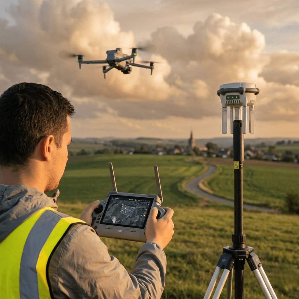
In short: for construction site monitoring, the Surveying Pack DJI Matrice 4E + RTK (in stock, quote on request) documents progress and delivers accurate orthophotos on every pass – request a quote.
1 cm + 1 ppmhorizontal RTK accuracy (RTK Fix), no ground control points needed for most surveys
2.8 km²area covered per flight in mapping mode
49 minflight time per battery on the DJI Matrice 4E
Who is this for?
This solution is designed for construction companies that want to document their sites and ensure reliable measurements, without an in-house drone pilot.
General contractors and structural works
Document every stage of site progress with dated, georeferenced orthophotos. A usable visual record from groundbreaking to handover.
Earthworks and site utilities (VRD)
Calculate earthworks and stockpile volumes (cut and fill), and generate contour lines and cross-sections thanks to the Matrice 4E’s integrated RTK module and processing in DJI Terra.
Developers and project owners
Get a dated orthophoto at every key milestone of the project, useful for tracking progress and documenting its evolution in your reports.
Real-world uses on your construction site
Progress tracking: dated orthophotos and comparison
Every flight of the DJI Matrice 4E produces a high-resolution, georeferenced orthophoto of the site. Captured at regular intervals, these images build a visual record of the site that you can compare from one visit to the next to objectively track progress.
Volume calculations: processing in DJI Terra
The RTK module integrated into the Matrice 4E reaches an RTK Fix accuracy of 1 cm + 1 ppm horizontal and 1.5 cm + 1 ppm vertical, without ground control points (GCPs) for most missions. Processed in DJI Terra, this data produces digital surface models (DSM) and point clouds you can use to calculate earthworks and stockpile volumes (cut and fill), as well as contour lines and cross-sections.
Documentation and handover: georeferenced imagery
The orthophotos and models generated are exported in GeoTIFF and LAS formats, compatible with AutoCAD, QGIS, ArcGIS and Agisoft Metashape. This georeferenced documentation provides a solid basis for your handover files and exchanges with engineering firms.
The equipment recommended for your site
Two DJI Matrice 4E packs cover the needs of construction sites, depending on your accuracy requirements and network coverage.
DJI Matrice 4E + RTK Surveying Pack
On request
The primary choice for your site volume calculations. Adds a D-RTK 3 Multifunctional station and a mast/tripod kit to the Matrice 4E, for guaranteed centimetre-level autonomous RTK accuracy, even without mobile network coverage.
- DJI Matrice 4E with integrated RTK + 5 batteries
- DJI Cellular Dongle 2: NTRIP correction via the free Walcors (Wallonia) and Flepos (Flanders) networks
- D-RTK 3 Multifunctional station + mast/tripod kit (backup without 4G coverage)
- DJI Terra Online licence, 1 year
- DJI Care Enterprise Plus, 1 year, renewable twice
DJI Matrice 4E Photogrammetry Pack
On request
A lighter alternative. For general mapping and inspection missions in areas with 4G coverage, without the need for autonomous RTK accuracy: 4 extra batteries and 4G Walcors connectivity.
Surveyors, engineering firms and construction contractors who need georeferencing without ground control points, including in rural areas: choose the Surveying Pack. For general mapping and inspection missions in areas with 4G coverage, the Photogrammetry Pack covers most of your needs.
Automated daily monitoring: the Dock option
For daily progress monitoring without mobilizing a pilot on site, the DJI Dock 3 lets you schedule automatic site documentation rounds. This option is detailed on our page Site Surveillance and Drone in a Box.
The beginner's path: 4 steps to get started
Your teams are not drone pilots yet? Here is the path we recommend so you can equip yourself with confidence.
1
The remote pilot licence
Before flying a professional drone, your teams must obtain the remote pilot licence suited to their activity. We partner with École du Drone, a UAS training centre recognized by the DGTA (Belgian civil aviation authority), which delivers Open (A1/A2/A3), Specific (STS01) and SORA training courses.
2
DPC product and photogrammetry training
Once the licence is obtained, your operators take our FlightHub 2 – Level 2: Inspection and Photogrammetry training course (1 day, in person at our Nivelles workshop), delivered by a DJI Enterprise certified instructor. Theory, demonstration and hands-on practice on the full workflow, from flight planning to data processing in DJI Terra. Our training courses are product training: they do not replace the remote pilot licence.
3
Equipment delivered and configured
Your surveying or photogrammetry pack is delivered anywhere in Belgium and the Benelux within 24 hours, ready to use on arrival.
4
Protection and maintenance
The Matrice 4E in your pack is covered by 1 year of DJI Care Enterprise Plus, renewable up to twice. For preventive maintenance, the DJI Maintenance Basic and Standard plans for the Matrice 4E are listed in our maintenance programme.
Frequently asked questions
Do you need to be a professional pilot to use this equipment?
Your teams must hold the remote pilot licence suited to their mission (Open or Specific, depending on the aircraft’s weight and the flight environment). Drone Parts Center does not provide flight training itself: we refer our clients to our partner École du Drone. Our own training focuses on mastering the equipment and the photogrammetry workflow, not on obtaining the licence.
How long does it take to train a site manager?
Our FlightHub 2 – Level 2: Inspection and Photogrammetry product training lasts one day. For the remote pilot licence, the duration depends on the target category (Open or Specific): École du Drone will provide the programme suited to your teams’ profile and needs.
What accuracy can be achieved for volume calculations?
The RTK module integrated into the DJI Matrice 4E reaches, in RTK Fix mode, an accuracy of 1 cm + 1 ppm horizontal and 1.5 cm + 1 ppm vertical, without ground control points for most missions. The Surveying Pack adds an autonomous D-RTK 3 station to guarantee this accuracy even without mobile network coverage.
Can the drone fly over a construction site in a city?
This depends on the regulatory category of your mission (Open or Specific under EASA regulation) and the authorizations managed by the DGTA in Belgium. Each site has its own constraints regarding the environment and flight over third parties. We support you through the process if needed, and refer your teams to our partner École du Drone for the corresponding regulatory training.
What does the drone actually deliver after a flight?
After processing in DJI Terra, you get orthophotos and digital surface models (DSM) in GeoTIFF format, as well as point clouds in LAS format. These deliverables are compatible with AutoCAD, QGIS, ArcGIS and Agisoft Metashape.
Can daily photographic site monitoring be automated?
Yes, using the DJI Dock 3: the station takes off and flies the drone on scheduled rounds, without a pilot on site. This option, separate from the surveying and photogrammetry packs presented here, is detailed on our page Site Surveillance and Drone in a Box.