


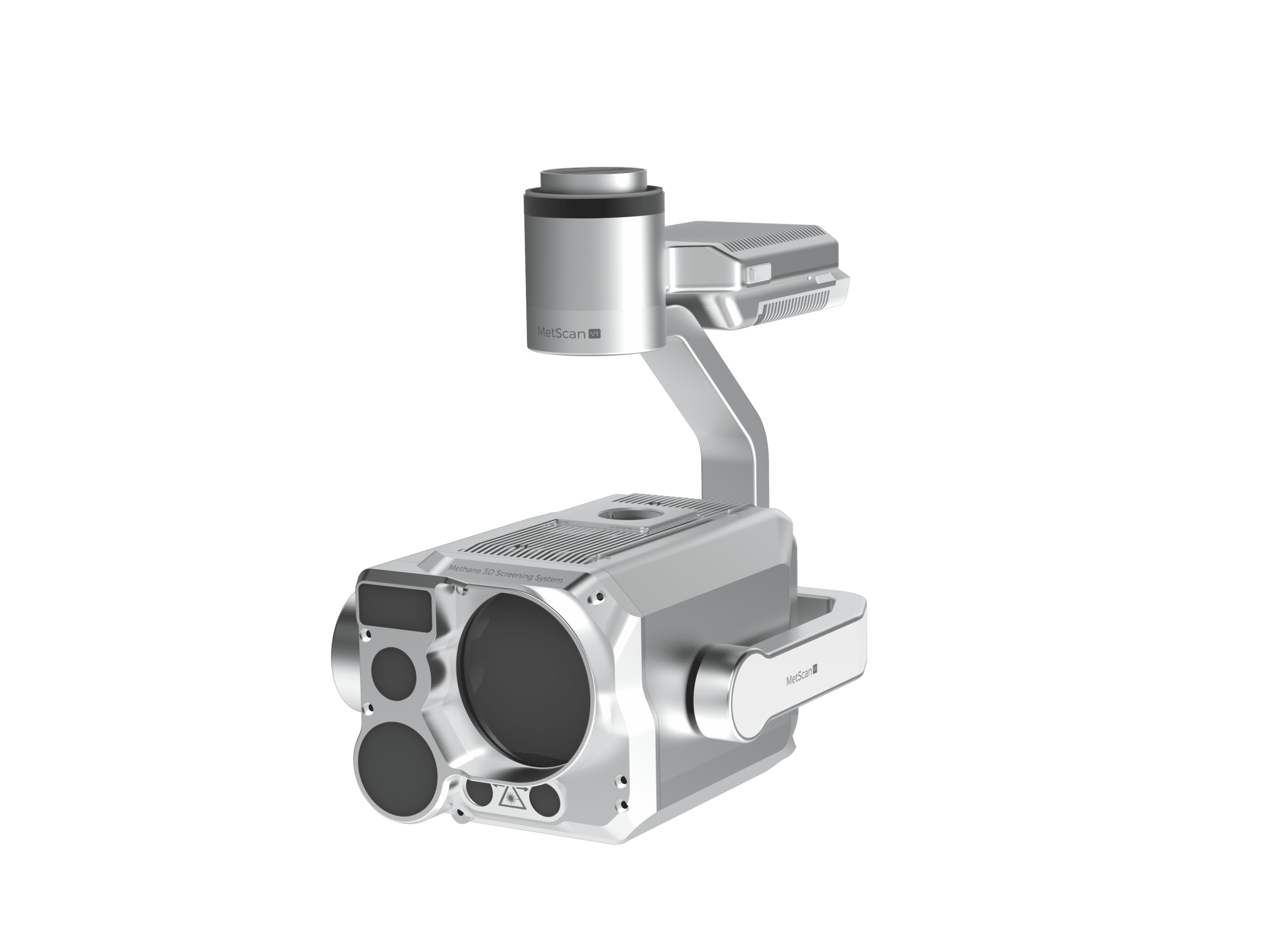
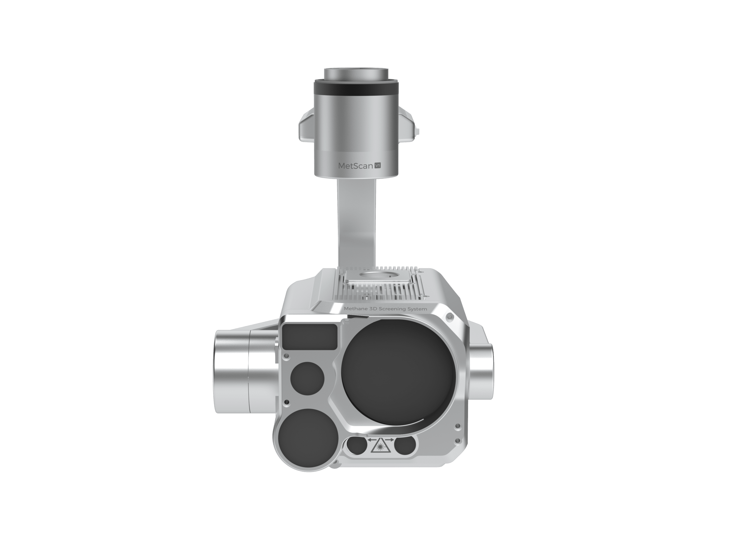

MetScan V1P (MS-1), remote methane detection by drone, TDLAS laser

Remote methane detector for the DJI Matrice 400 and Matrice 350 RTK: open-path TDLAS laser on a 3-axis gimbal, measurement from 100 to 99,999 ppm·m at 50 Hz, laser rangefinder, wide-angle and telephoto cameras, Belt Scan and Sector Scan modes. Leaks are located and ranked in AIRINS.ai, with PDF or DOCX reports for your LDAR and OGMP 2.0 programmes. Ultra and Standard versions. 890 g.
At a glance
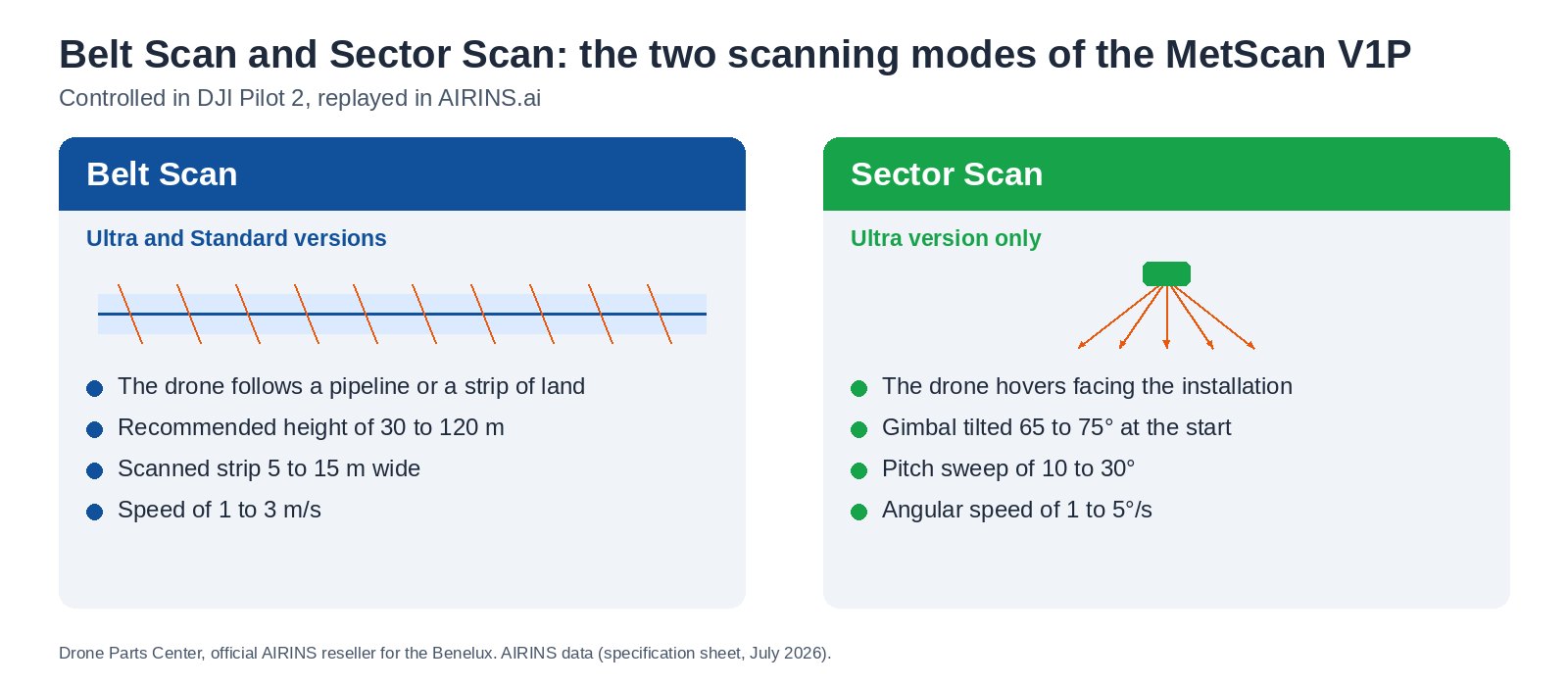
The MetScan V1P detects methane remotely: from a DJI Matrice 400 or Matrice 350 RTK, its TDLAS laser sweeps the ground and measures the methane column crossed, up to 50 times per second, without flying over the leak. A 3-axis gimbal, a rangefinder, a dual camera and two scan modes make it AIRINS’ reference tool for LDAR campaigns on pipelines and installations. Drone Parts Center, official AIRINS reseller for the Benelux, advises you on the Ultra or Standard version.
100 to 99,999 ppm·m
methane column measuring range
50 Hz
measurement frequency
Up to 300 m
detection distance according to AIRINS
35 and 300 mm
wide-angle and telephoto cameras, 35 mm equivalent
890 g
including the 3-axis gimbal
IP54
from -20 to +55 °C
A remote methane detector for drone-based LDAR campaigns
The MetScan V1P is the long-range methane detector in the AIRINS range. Its 1,650 nm infrared laser passes through the plume, reflects off the ground or the installation and returns to the sensor: the share absorbed gives the amount of methane crossed, in ppm·m. A green laser marks the laser spot, a rangefinder measures the distance, and the position of each measurement point is estimated in longitude, latitude and altitude. The drone stays at a distance from the source, which suits gas distribution networks, production sites, landfills and wastewater treatment plants. For the Matrice 4D / 4TD and the Dock 3, see the compact MetScan Nano 1D and MetScan Nano 1F detectors.
Two scan modes
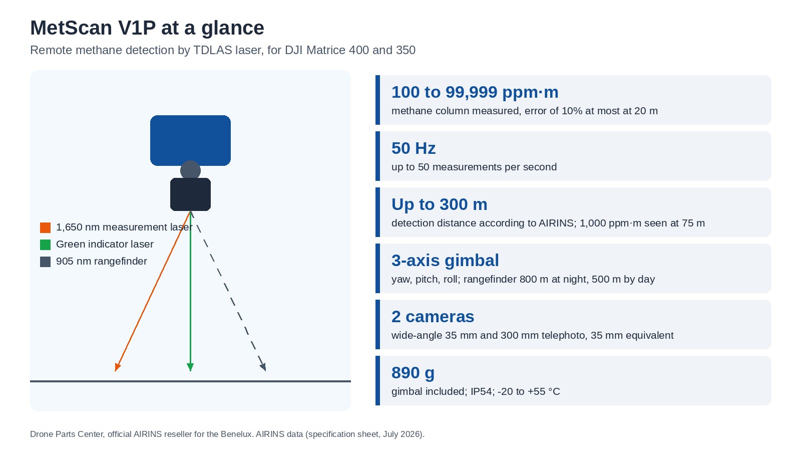
In Belt Scan mode, the drone follows a pipeline or a strip of land at a height of 30 to 120 m, and the laser sweeps a band 5 to 15 m wide at 1 to 3 m/s. In Sector Scan mode, available on the Ultra version only, the drone hovers while the gimbal sweeps a sector of the installation, tilting the laser in steps of 10 to 30°. Both modes are controlled in DJI Pilot 2 and can be replayed in AIRINS.ai.
What the sensor sees and measures
- Open-path TDLAS measuring laser, 1,650 nm, class 3R, with a green laser indicating the laser spot.
- Class 1 laser rangefinder: 800 m at night, 500 m in daylight.
- Wide-angle camera of around 35 mm and telephoto of around 300 mm in 35 mm equivalent, displayed together in DJI Pilot 2, with video synchronised with the measurements.
- 3-axis gimbal (yaw, pitch, roll), with the position of the laser spot estimated in longitude, latitude and relative altitude.
- Typical results published by AIRINS: a 1,000 ppm·m cloud detected continuously at 75 m in sunny weather, 2,500 ppm·m at 100 m in overcast weather.
Ultra and Standard versions
Both versions share the same sensor. The Standard version covers Belt Scan and 2D visualisation in AIRINS.ai, with CSV and KML exports. The Ultra version adds Sector Scan, 3D visualisation with laser beams, import of orthoimages and 2.5D / 3D models, AI hotspot detection in 3D, mission merging, GeoJSON and Shapefile export, MQTT transfer, web integration and deployment on your own servers. An upgrade from Standard to Ultra remains possible after purchase.
| Feature | Ultra | Standard |
|---|---|---|
| Belt Scan | Yes | Yes |
| Sector Scan | Yes | No |
| Visualisation | 2D and 3D with laser beams | 2D |
| Import of orthoimages and 2.5D / 3D models | Yes | No |
| AI hotspots | 3D | 2D |
| Mission merging and animations | Yes | No |
| Exports | CSV, KML, GeoJSON, Shapefile | CSV, KML |
| MQTT transfer and web integration | Yes | No |
| Deployment on your servers | Yes | No |
| Video storage | 250 h | 30 h |
AIRINS.ai, included with purchase
The AIRINS.ai software is included with purchase, for perpetual use with one unit and one main account, together with one year of remote technical support and updates. A subscription is available as an alternative to purchase. The platform locates hotspots, ranks them by intensity in ppm·m with a confidence index, and produces PDF or DOCX reports with map links, for use in your LDAR and OGMP 2.0 programmes. European data is hosted on isolated servers within the European Union. Quantification in kg/h, which requires wind measurements, is available as an option.
Compatibility and installation
The MetScan V1P mounts on the DJI Matrice 400 and the DJI Matrice 350 RTK via the DJI SkyPort adapter, and is controlled through PSDK in DJI Pilot 2. A standalone version, with its own GNSS and inertial measurement unit and an 18 to 32 V power supply, can be installed on other platforms and is controlled from AIRINS.ai. The 4G connection is used for updates and synchronisation, while 2.4 GHz Wi-Fi and the USB-C port are used for data transfer. Details for each drone are given in our AIRINS and DJI compatibility table.
Warranty, calibration and service life
Warranty. Standard one-year warranty. The extension can only be purchased with the initial order, at 20% of the total product value per additional year, up to two years of extension. After the warranty period, the hardware and software remain fully usable.
Calibration. Units are factory-calibrated before shipment. Recalibration is recommended every 12 months in a stable operating environment. If working conditions change (temperature, measurement environment), some modules require their zero point to be readjusted. Two methods are available:
- By the customer. Injection of a calibration gas or comparison with the reference equipment of a measuring station. The new correction factor is calculated using the manufacturer’s formula, then saved in the calibration interface of the AIRINS.ai platform.
- By return to the factory, for annual inspection and calibration. Free of charge during the warranty period, with shipping costs borne by the customer. Outside the warranty, it is invoiced according to the inspection results, with costs communicated for prior approval.
Service life. 3 years on average, depending on how often the unit is used and the concentration levels encountered. This lifetime is shorter with frequent use in heavily polluted areas.
Technical specifications
| Measuring principle | Diffuse-reflection OP-TDLAS, open-path, methane only |
| Measuring range | 100 to 99,999 ppm·m |
| Measurement error | 10% at most, from 1,000 to 50,000 ppm·m at 20 m |
| Measurement frequency | Up to 50 Hz |
| Lasers | 1,650 nm measuring laser and 520 nm green indicator, class 3R; 905 nm rangefinder, class 1 |
| Rangefinder | 800 m at night, 500 m in daylight |
| Cameras | Wide-angle around 35 mm, telephoto around 300 mm (35 mm equivalent) |
| Gimbal | 3-axis: yaw, pitch, roll |
| Dimensions | Around 192 × 129 × 172 mm, including gimbal |
| Weight | Around 890 g, including gimbal |
| Ingress protection | IP54 |
| Operating temperature | -20 to +55 °C |
| Drones | DJI Matrice 400 and Matrice 350 RTK, DJI SkyPort adapter; 18 to 32 V standalone version for other platforms |
| Control | DJI PSDK, data and controls in DJI Pilot 2 |
| Connectivity | 4G (SIM card), 2.4 GHz Wi-Fi, USB-C |
| Software | AIRINS.ai included with purchase, Ultra and Standard versions |
| In the box | MetScan V1P, lens cap, adapter cover, dual USB-C cable, dust blower, reference methane cell of around 1,700 ppm·m, accessory case, carrying case, quality control certificate |
See the MetScan V1P in action
Order from Drone Parts Center
Drone Parts Center, official AIRINS reseller for the Benelux, helps you choose between Ultra and Standard and provides training in Nivelles or at your site. Request a quote: purchase orders accepted from public authorities, intra-EU VAT-exempt invoicing for VAT-registered businesses. To measure the concentration in the air rather than remotely, see the Sniffer4D Nano 2 Plus Methane. Explore the full AIRINS range and our environmental monitoring solutions.
Frequently asked questions
What is the difference between the MetScan V1P and the Sniffer4D Nano 2 Plus Methane?
The MetScan V1P measures the methane column crossed remotely, by laser, in ppm·m: it locates a leak without flying over the source. The Sniffer4D Nano 2 Plus Methane measures the concentration in ppm of the air passing through its cell, while the drone flies through the plume.
Is the MetScan V1P suitable for LDAR and OGMP 2.0 requirements?
It locates and ranks leaks, and AIRINS.ai produces PDF or DOCX reports that can be used in LDAR and OGMP 2.0 programmes. Quantification in kg/h, which requires wind measurements, is available as an option.
What is the difference between Ultra and Standard?
Both use the same sensor. Standard: Belt Scan, 2D visualisation, CSV and KML exports, 30 h of video. Ultra: adds Sector Scan, 3D, model import, mission merging, GeoJSON and Shapefile exports, MQTT, deployment on your servers, 250 h of video. An upgrade to Ultra remains possible after purchase.
Does it detect gases other than methane?
No. The laser is tuned to methane and does not respond to any other gas. For multi-gas air quality monitoring, see the Sniffer4D Nano 2 Plus Multi-Gas.
Is there a version for the DJI Matrice 4D / 4TD and the Dock 3?
Yes: the MetScan Nano 1D, downward-facing, and the MetScan Nano 1F, forward-facing, connect directly to the Matrice 4D / 4TD and fly from the DJI Dock 3.
From what distance can it detect a leak?
AIRINS states a detection distance of up to 300 m and cites, in real conditions, a 1,000 ppm·m cloud detected at 75 m in sunny weather and 2,500 ppm·m at 100 m in overcast weather. Cloud size, the reflecting surface and sunlight all affect the range.
What warranty and calibration does it come with?
Standard one-year warranty, which can be extended with the initial order at 20% of the product value per year, up to two years of extension. Recalibration is recommended every 12 months, either by the customer or at the factory.
Only logged in customers who have purchased this product may leave a review.
Related products
Environmental Monitoring
MetScan Nano 1D, downward-facing drone methane detection, TDLAS laser
Available to order: contact us for lead time.
Environmental Monitoring
Sniffer4D Nano 2 Plus Methane, TDLAS laser methane detection by drone
Available to order: contact us for lead time.
Environmental Monitoring
MetScan Nano 1F, forward-facing drone methane detection, TDLAS laser
Available to order: contact us for lead time.
Environmental Monitoring
Available to order: contact us for lead time.
Environmental Monitoring
Available to order: contact us for lead time.
Environmental Monitoring
Available to order: contact us for lead time.
Reviews
There are no reviews yet.