
 Français
 Nederlands
 Deutsch
Regulation & Certification
Drone methane detection: what the European Regulation changes for pipeline operators
Apr
March 2026 · Drone Parts Center
Somewhere in Wallonia, a natural gas transmission pipeline crosses 35 kilometres of countryside. Every quarter, the operator must demonstrate that it has inspected its network for possible methane leaks. It’s the law – and it’s just tightened.
The European Methane Regulation (EU 2024/1787), in force since 2024, requires operators in the energy sector to have more frequent, better documented and more transparent LDAR (Leak Detection And Repair) programmes. Traditional ground-based methods – handheld sniffers, OGI cameras, measurement vehicles – work, but they cover slowly and are expensive on wide area networks.
This is where the drone comes in.
What is changing concretely
The Regulations do not prescribe a specific technology. But it requires regular, documented inspections, with traceability of the results. LDAR programs need to cover the entire network – not just the easy-to-reach points.
For an operator who manages tens of kilometres of pipeline, this represents a considerable volume of inspection. River crossings, steep areas, private land segments – all points that ground crews can only inspect at great cost and with significant delays.
The OGMP 2.0 (Oil & Gas Methane Partnership) framework, supported by UNEP, adds an additional dimension: reconciliation between measurements at the component level (bottom-up) and at the site level (top-down). Aerial screening is naturally positioned between these two approaches.
What the drone brings – and what it doesn’t replace
Let’s be clear: a drone with a methane sensor is not a substitute for detailed component-level inspection. When it is necessary to identify which valve is leaking on which flange, a technician with a handheld sniffer or an OGI camera, in contact with the equipment, is needed.
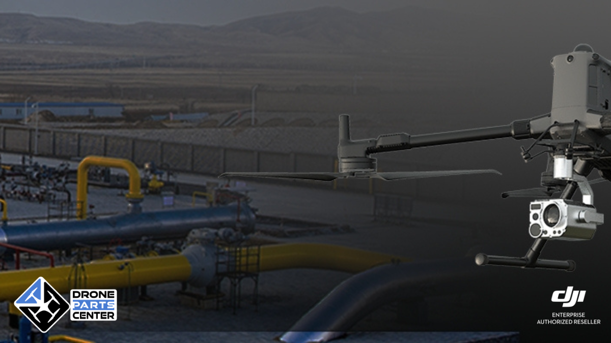
What the drone does better than anyone else is rapid screening on a large scale. A MetScan V1 mounted on a DJI Matrice 400 covers 5 to 15 km of pipeline per flight. Its TDLAS laser automatically scans both sides of the path, forming a continuous band of geo-referenced measurements. At the end of the mission, the AIRINS.ai platform locates the hotspots on a map – and the field team knows exactly where to focus their efforts.
This is the difference between inspecting 35 km blindly and inspecting 4 target points.
Workflow in practice
The operator plans their mission in DJI Pilot 2 – waypoints along the pipeline. The drone takes off with the MetScan. During the flight, the data can be viewed in real time in AIRINS.ai to verify that there is sufficient coverage.
Back on the ground, the data synchronizes to the cloud. AIRINS.ai generates 2D and 3D concentration maps, identifies AI suspected hotspots, and produces an inspection report with GPS coordinates, synchronized imagery, and key indicators. Data is exported as a shapefile, GeoJSON, and CSV for integration into the operator’s GIS systems.
Each mission is archived. Campaigns are comparable over time. The documentation is native – exactly what the Regulations require.
MetScan Ultra, Standard, or subscription?
Since 2026, AIRINS has been offering two variants of the MetScan V1. The Ultra (€40,000 excl. VAT) offers 3D visualization, Sector Scan for installations, GIS exports and on-prem deployment. The Standard (€20,000 excl. VAT) focuses on 2D Belt Scan – enough for operators who mainly inspect linear pipelines.
For operators who want to test before investing, the Ultra is also available as a quarterly subscription: a security deposit of €5,000 and a charge of €3,000 per quarter, including 200 km of flight. No annual commitment.
And for Dock 3 deployments, the MetScan Nano 1 (available Q2 2026) will bring the same technology in a compact form factor compatible with programmed autonomous missions. The drone takes off on its own, scans the pipeline, and the data arrives in AIRINS.ai without a pilot being on site.
And in Belgium?
Belgium, with its transmission network operated by Fluxys and its distribution networks managed by the regional operators, is directly affected by the Regulation. Belgian operators will have to demonstrate that their LDAR programmes effectively cover their infrastructure.
Drone Parts Center, based in Nivelles, is an authorized AIRINS partner and an authorized DJI Enterprise reseller. We support operators in the choice of the system (MetScan V1 or Nano 1, purchase or subscription), field deployment, team training, and ongoing technical support.
What you need to remember
The EU Methane Regulation will mechanically increase the volume of inspections. Aerial screening by drone offers an operational response to effectively cover large infrastructures, prioritize field interventions and document the results. This is not a technology of tomorrow – MetScan systems are deployed today in real-world operations, including in Europe.
See in action
A Practical Workflow for Gas Pipeline Leak UAV Inspection (1:00)
More Coverage, Less False Alarms (0:25)
Frequently asked questions
When does the EU Methane Regulation come into force?
Regulation (EU) 2024/1787 entered into force in August 2024. Leak detection and repair obligations (LDAR) are gradually being applied to European gas operators.
Can the MetScan replace LDAR ground inspections?
The MetScan V1 is an aerial screening tool that identifies suspicious areas. It complements OGI ground inspections by covering large areas quickly. The combination of the two approaches maximizes LDAR efficiency.
MetScan Ultra or Standard for EU compliance?
The Ultra is recommended for regulatory compliance: 3D visualization, Sector Scan, GIS exports (shapefile, GeoJSON) and on-prem deployment. The Standard is suitable for basic screening.
Drone Parts Center – Authorized AIRINS Partner – Nivelles, Belgium