
 Français
 Nederlands
 Deutsch
Photogrammetry


Photogrammetry
Available to order (please contact us)

Carry out centimetre-accurate photogrammetric surveys by drone with our DJI Enterprise solutions. Aerial photogrammetry is revolutionising topography, mapping and 3D modelling for surveyors, engineering firms and civil engineering companies across the Benelux.
Drone photogrammetry solutions
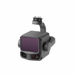
DJI Zenmuse P3: Oblique photogrammetric sensor with 5 lenses for maximum coverage in a single pass. Ground resolution down to 1.5 cm.
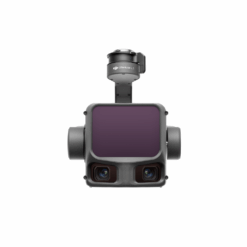
DJI Zenmuse L3: High-precision LiDAR for 3D modelling beneath vegetation cover and in complex environments.
D-RTK 3 Station: Mobile RTK base for centimetre accuracy without an NTRIP network. Compatible with the Walcors network in Belgium.
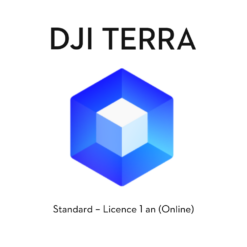
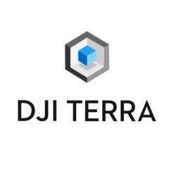
DJI Terra V5.0: Processing software with Gaussian Splatting for ultra-realistic 3D models. Export in standard formats (LAS, OBJ, OSGB).
Which drone for photogrammetry in 2026?
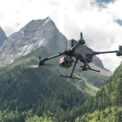
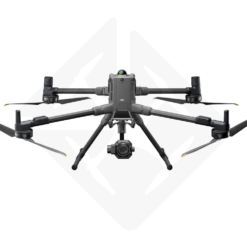
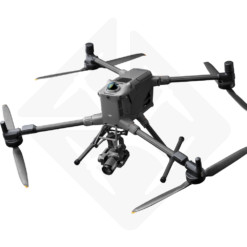
The Matrice 400 RTK and the Matrice 350 RTK are the platforms of choice for complex photogrammetric missions. For rapid surveys, the Mavic 3 Enterprise RTK offers a compact alternative. Also check our article on the Belgian Lambert 1972 system with DJI Terra and the D-RTK 3 vs Emlid Reach RS3 comparison. Request a quote.