
 Français
 Nederlands
 Deutsch
News
DJI Terra and the Belgian Lambert 1972 system
Mar
Drones, or unmanned aerial vehicles (UAVs), are increasingly being used by surveyors to collect topographic data faster, safer and more efficiently. UAVs can be equipped with cameras, laser scanners and other sensors to collect precise data on the earth’s features, including landforms, altitudes and distances.
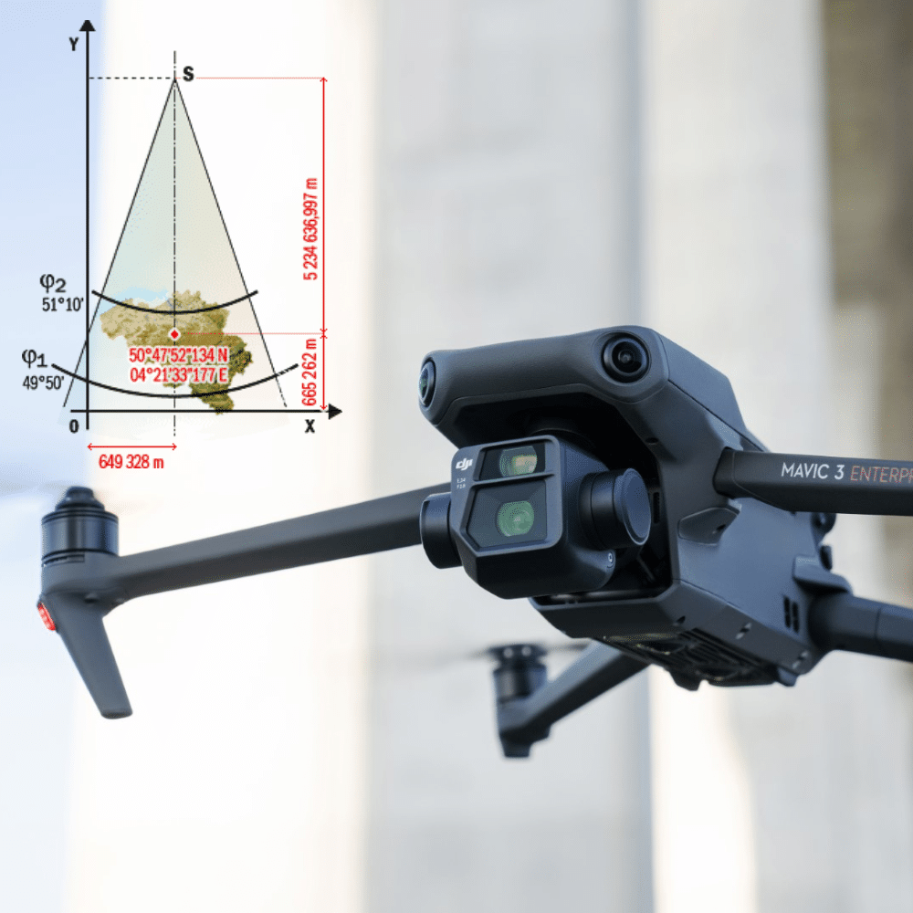
The Lambert 1972 system is a map projection system widely used in Europe, notably in France and Belgium, to represent topographic data on maps. This system uses a conformal conic projection to represent the earth’s surface on a flat map. It was developed in 1972 to replace the Lambert 1950 system.
Drones can be used to collect topographic data in the Lambert 1972 system, using sensors such as cameras and laser scanners to collect position and elevation data. The data collected can then be used to create topographic maps and models using mapping and 3D modeling software.
Using drones to collect topographic data offers many advantages over traditional methods. Drones can collect data faster and more efficiently than field crews, reducing the time and costs associated with data collection. Drones can also access hard-to-reach or dangerous areas, such as cliffs or areas at high risk of avalanches.
In addition, drones can be equipped with high-precision sensors that can collect more accurate data than traditional methods. Drones can also fly at higher altitudes to cover larger areas, making it possible to collect data on entire regions in a single mission.
In conclusion, the use of drones in surveying is becoming increasingly common, offering many advantages over traditional methods of topographic data collection. Drones can be used to collect data in the Lambert 1972 system, using high-precision sensors to create accurate, detailed topographic maps and models.
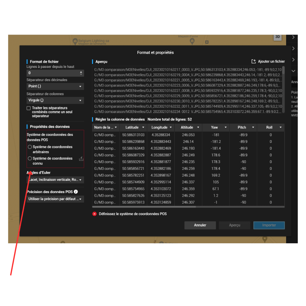
Before you can process your initial work in the DJI Terra photogrammetry software, you need to go through the process of setting coordinates. If you don’t do this, you’ll get errors and your drone’s readings won’t be valid.
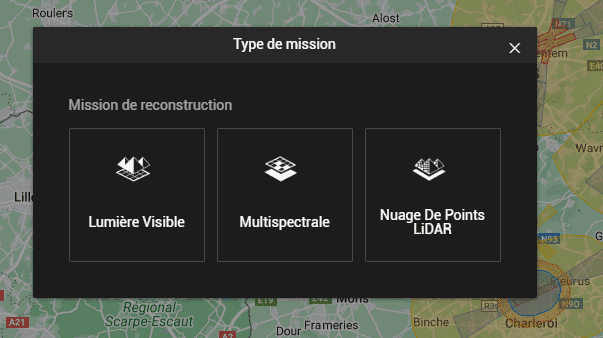
In this mission example we will choose a visible light mission.
Before starting the rebuild, you need to set up the cordata parameters.
Choose a known coordinate system
The values to be integrated are Belge 1972
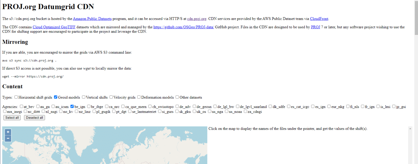
For Geoid parameters, this is the Ostend height, you’ll need to check the altitude of your land here https://cdn.proj.org/
On this site, in Content/types, you choose Goid Models and in Agencies the be-ign box only; the other boxes must be unchecked.
You zoom into the image and find the field where you were for your flight. Here we were in Nivelles.
Simply point your mouse over the area and you’ll get, in our case, a geoid_undulation of 43.269 meters.
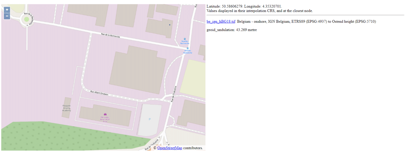
This value is to be referenced in DJI Terra but with a minus in front of the number, so here -43.269m
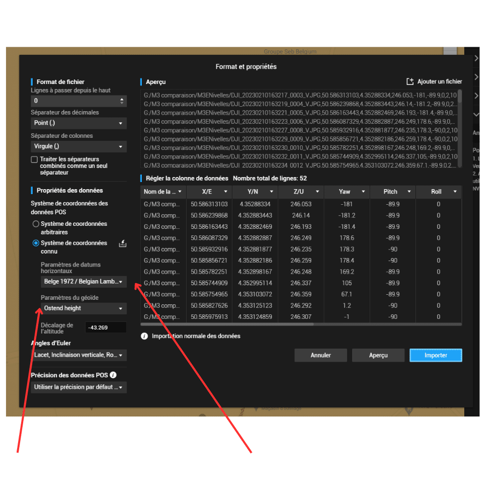
From this point on, you can start the reconstruction and the values will be correct.