
 Français
 Nederlands
 Deutsch
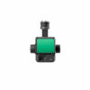
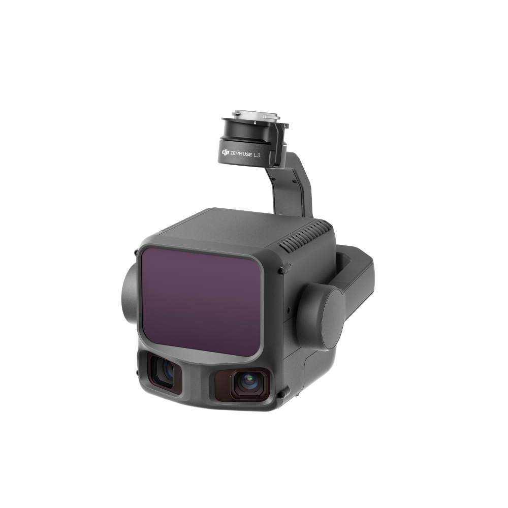
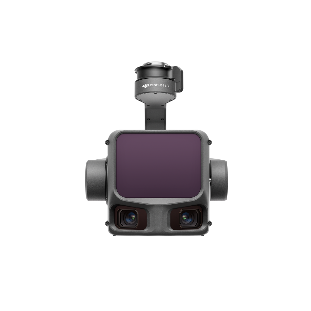

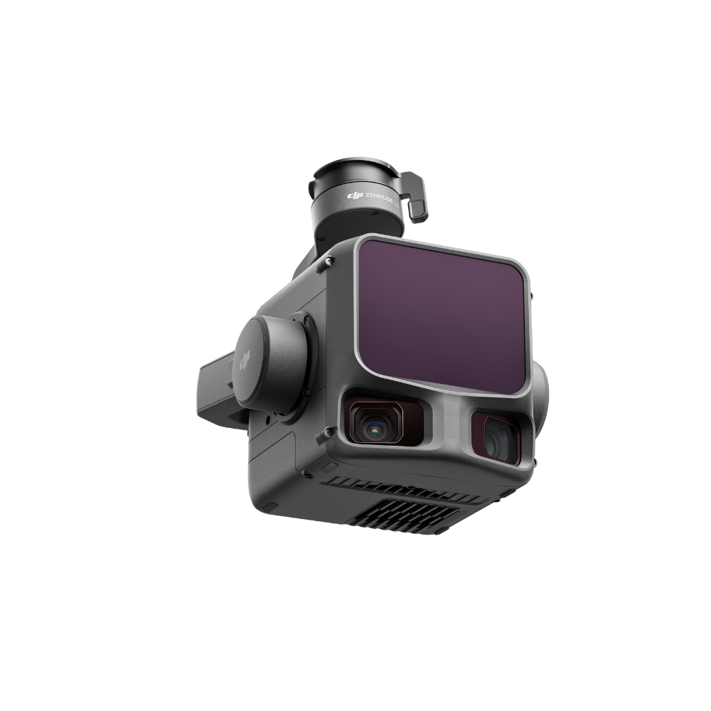


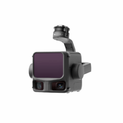

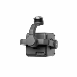
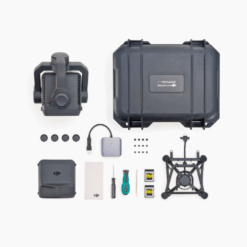
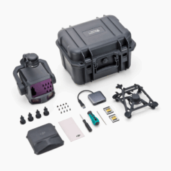
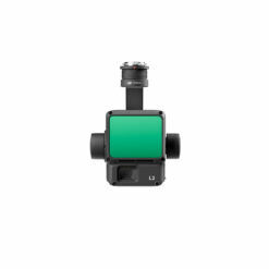
DJI Zenmuse L3
€ 14.999,00
The DJI Zenmuse L3 is DJI’s first long-range, high-precision aerial LiDAR system. It redefines efficiency and accuracy for surveying, inspection, and 3D modeling professionals.
- Revolutionary Scope: Up to 950 meters on objects with low reflectivity (10%).
- Centimeter Accuracy: Achieves a vertical accuracy of 3 cm and a horizontal accuracy of 4 cm at an altitude of 120m.
- Superior Penetration: Up to 16 laser returns and an ultra-fine spot for detailed capture under vegetation.
- Fusion LiDAR + Dual 100MP Camera: Create photorealistic colorized point clouds and 2D/3D models in a single flight.
- Integrated ecosystem: Free and powerful processing with DJI Terra, and smart mission planning with DJI Pilot 2.
Matrice 400 Exclusive: The Zenmuse L3 is the definitive tool for professionals who demand the best.
Available to order (please contact us)
The Evolution of LiDAR Performance: A Quantum Leap
The Zenmuse L3 is not just an evolution, it’s a revolution. It outperforms its predecessors and the competition thanks to major technological advances that result in productivity gains and spectacular data quality.
| Characteristic | Zenmuse L1 | Zenmuse L2 | Zenmuse L3 |
|---|---|---|---|
| Number of returns | 3 | 5 | Up to 16 |
| Max. | 190 m | 450 m | 950 m |
| Typical | 6-10 cm | 4-5 cm | 2-4 cm |
| Laser spot size (@120m) | N/A | ~205 mm | Ø 41 mm |
| Camera(s) | 20 MP | 20 MP | Dual 100 MP camera |
| IMU | Required | Not required | Not required |
LiDAR Performance: Power for Precision
Exceptional Range and Superior Penetration
With a measurement range of up to 950 meters and the ability to handle up to 16 laser signal returns , the L3 transforms the way you approach large-scale projects. Fly higher and cover more ground with each pass, while capturing fine details under the forest canopy or on intricate structures. The 1535 nm laser power ensures exceptional penetration, giving you a clear view of the ground, even in the harshest conditions. For maximum penetration into vegetation, it is recommended to use a rate of 350 kHz with 16 returns.
Reliable centimeter accuracy
The Zenmuse L3 achieves a vertical accuracy of 3 cm and a horizontal accuracy of 4 cm at an altitude of 120 meters. This remarkable performance is made possible by a combination of advanced technological factors. The high-precision IMU offers an angular accuracy of 0.01° and requires no warm-up time, allowing you to start your missions instantly. The ultra-small laser spot size, with a diameter of only 41 mm at 120 m (80% smaller than the L2), makes it possible to detect the finest objects such as power lines and generate incredibly sharp 3D models. The adjustable point rate up to 2 MHz provides complete flexibility to suit every mission.
| Points | Recommended | Max. number of returns |
|---|---|---|
| 100 kHz | ≤ 500m | Art. 16 |
| 350 kHz | ≤ 300m | Art. 16 |
| 1000 kHz | ≤ 100m | 8 |
| 2000 kHz | ≤ 50m | 4 |
Three Scan Modes for Every Application
The Zenmuse L3 offers three distinct scan modes to suit your specific needs. The
Dual RGB Camera: The Perfect Fusion of LiDAR and Photogrammetry
The Zenmuse L3 doesn’t just capture geometry; It also captures reality in color. Equipped with two RGB cameras with a Micro 4/3 sensor totaling 100 megapixels, it generates colorized point clouds in real time and photogrammetric images of exceptional quality. The cameras offer an ultra-wide viewing angle of 107°, which is 27° wider than the FOV of LiDAR, ensuring full colorization and high-quality orthophotos. The mechanical shutter is rated for 500,000 cycles, ensuring rock-solid durability. The GSD reaches 1.2 cm at 120 m altitude and 3 cm at 300 m, allowing reconstructions with remarkable precision.
An Integrated and Powerful Software Ecosystem
The Zenmuse L3 integrates seamlessly into the DJI ecosystem for a streamlined workflow from acquisition to final delivery.
DJI Pilot 2: Intelligent Planning and Acquisition
Plan your intelligent flight missions with multiple modes to suit each application. Area Route mode is ideal for mapping large areas.
DJI Terra: Free and Powerful Processing
Enjoy free and unlimited data processing with DJI Terra. The software handles POS calculation (Data POS and Local PPK), accuracy optimization, LiDAR and RGB data fusion, and generates comprehensive quality reports with a single click. DJI Terra now supports Gaussian Splatting for ultra-realistic 3D reconstructions with optimal compression (TerraGS format occupying only 33% PLY). Fusion reconstruction allows the generation of 2D maps (DOM and DSM) and 3D models in many formats (B3DM, PLY, OSGB, S3MB, OBJ, I3S). Ultimate Performance mode significantly improves rebuild efficiency on systems with Intel 13th or 14th Gen CPUs and Windows 11.
DJI Modify: Advanced Point Cloud Editing
Edit and repair your point clouds with advanced tools. DJI Modify now supports editing LAS files larger than 120 GB on computers with 32 GB RAM, ground point editing with real-time terrain preview, and measurement in the Profile view. The software also supports NVIDIA RTX 50 series graphics cards for optimal performance.
Advanced Features for Maximum Efficiency
Real-time on-site measurement
DJI Pilot 2 enables real-time measurements (points, lines, surfaces, volumes) directly on the remote controller with a preview of the point cloud. This feature is ideal for quick investigations or emergency mapping. The point cloud is diluted to 5% for optimal responsiveness, with accuracy reduced to 50%. Measurements can be synchronized with DJI FH2 (cloud) for more advanced and detailed analysis.
Automatic Parameter Recommendation
Based on the set flight altitude, the system automatically recommends an appropriate LiDAR point rate and camera resolution. This feature is especially useful for beginners, avoiding delaying the progress of the work due to incorrect settings.
Detailed use cases
Topography and Large-Scale Mapping
Thanks to its long range and high accuracy, the Zenmuse L3 can perform topographic surveys on a scale of 1:1000 or better, over large areas. Cover hundreds of square kilometers with unmatched efficiency. The 950m range allows flying at high altitudes for maximum coverage, while maintaining centimeter accuracy.
Infrastructure Inspection
The Power Line Follow mode and the finesse of the laser spot allow for safe and detailed inspection of power lines. The system supports transmission lines with a tracking height of 10 to 130 m (50 to 80 m recommended) and distribution lines with a tracking height of 10 to 50 m (30 to 50 m recommended). The 80° × 80° wide FOV and improved stability allow for a wider range of power lines to be identified at the same height. No heading calibration is required, allowing for higher flying for safer operation. The L3 is also ideal for inspecting railways, dams and ultra-high transmission towers.
Forestry and Archaeology
The ability to capture up to 16 returns provides unparalleled canopy penetration, essential for biomass analysis, species classification, or the discovery of remains beneath vegetation. The Zenmuse L3 allows for accurate modeling of multiple layers of the canopy as well as the ground, which was previously impossible with lower-performing sensors. This ability is also valuable for the investigation of geological hazards and the archaeology of cultural relics.
Digital Twins and Engineering
The fusion of LiDAR data and high-resolution images enables the creation of photorealistic 3D models for urban planning, construction site monitoring, and asset management. Gaussian Splatting offers superior visuals with optimal compression, allowing large-scale results (100 million dots) to be opened in seconds on a computer with 4 GB of VRAM, with smooth navigation at 30+ FPS.
Full Technical Specifications
| General Features | |
|---|---|
| Weight | ~1.6 kg |
| Ingress Protection | IP54 |
| Operating | -25°C to 55°C |
| Compatible | DJI Matrice 400 (exclusively) |
| Nacelle | 3 Axes (Pitch: -120° ~ +60°, Yaw: -80° ~ +80°, Roll: -90° ~ +60°) |
| LiDAR sensor | |
|---|---|
| Laser | 1535 nm, Max 100W, Class 1 |
| Max. range (@10% reflectivity) | 950 m |
| Recommended | 300-500 m |
| Accuracy (120m) | Vertical: 3 cm, Horizontal: 4 cm |
| Accuracy (300m) | Vertical: 5 cm, Horizontal: 7.5 cm |
| Points | 100 kHz / 350 kHz / 1 MHz / 2 MHz (adjustable) |
| Number of returns | Up to 16 (depending on point rate) |
| Laser spot size (@120m) | Ø 41 mm (1/e²) |
| divergence angle | 0.25 MRAD × 0.25 MRAD (1/e²) |
| Scan | Linear repeating, star-shaped, non-repeating |
| FOV | 80° × 80° |
| Inertial Navigation System (IMU) | |
|---|---|
| Angular | 0.01° & 0.02° (1σ) |
| Post-processed accuracy (Heading) | 0.02° (1σ) |
| Post-processed accuracy (Pitch/Roll) | 0.01° (1σ) |
| POS | 200 Hz |
| Preheating | Not required |
| Calibration | Automatic (heading and pitch/roll) |
| RGB cameras | |
|---|---|
| Configuration | Dual camera |
| Total | 100 MP (12K or 6K modes available) |
| Sensor | 4/3 CMOS microphone |
| Shutter | Mechanical (lifespan 500,000 cycles) |
| Min. | 0.5 sec (25 MP) / 1.0 sec (100 MP) |
| FOV | 107° (27° wider than LiDAR) |
| GSD (@120m) | 1.2 cm |
| GSD (@300m) | 3 cm |
| Laser Rangefinder (RNG) | |
|---|---|
| Maximum | 900 m (vs 500 m for L2) |
| Function | Measuring the distance between the LiDAR and the object at the center of the FOV |
Frequently Asked Questions (FAQs)
Q: Is the Zenmuse L3 compatible with the Matrice 350 RTK?
A: No, the Zenmuse L3 is exclusively compatible with the DJI Matrice 400 drone. This exclusivity is due to its higher power consumption (1535 nm 100W laser), its weight of 1.6 kg and the need to use the new gimbal holder specially designed for the L3. The power supply to the M350 nacelle does not meet the requirements of the L3.
Q: Is data processing with DJI Terra really free?
A: Yes, Zenmuse L3 data processing in DJI Terra is completely free and does not require any additional licenses. All basic and advanced functions are included, including fusion reconstruction, Gaussian Splatting, ground point classification, DSM/DEM and contour generation, and comprehensive quality reporting. A computer with 64 GB of RAM can process datasets larger than 100 km².
Q: What is the advantage of the 16 laser returns?
A: The 16 returns allow for much deeper vegetation penetration, providing detailed modeling of multiple canopy layers and accurate capture of ground points. This capability is crucial for forestry applications (biomass analysis, species classification), archaeological applications (discovery of remains under vegetation) and geological applications (risk investigation). To maximize penetration, it is recommended to use a rate of 350 kHz with 16 returns rather than 2 MHz with 4 returns.
Q: Does there need a warm-up time for the IMU?
A: No, the Zenmuse L3 IMU does not require any warm-up. It is ready to go as soon as the drone is turned on, saving valuable time in the field. The IMU automatically reaches its best operating state when entering the road for seamless efficiency. Heading and pitch/roll calibration is also done automatically during flight.
Q: Can I take measurements directly in the field?
A: Yes, DJI Pilot 2 allows real-time measurements (points, lines, surfaces, volumes) directly on the remote controller with a preview of the point cloud. This feature is ideal for quick investigations or emergency mapping. The point cloud is diluted to 5% for optimal responsiveness, with accuracy reduced to 50%. Measurements can be synchronized with DJI FH2 for more advanced analysis.
Q: What output formats are supported?
A: DJI Terra supports many output formats. For point clouds: LAS, LAZ. For Gaussian Splatting: TerraGS, PLY, 3D Tiles. For 3D models: B3DM, PLY, OSGB, S3MB, OBJ, I3S. For 2D maps: GeoTIFF (DOM, DSM, DEM), Shapefile (outlines). This flexibility allows for easy integration into your existing workflows.
Plan de Service DJI Care Enterprise Plus
With the purchase of the Zenmuse L3, get one year of DJI Care Enterprise Plus for free. This premium service includes:
- Unlimited free repairs within the coverage limit
- Complete protection of the device against accidental damage
- Free two-way shipping for hassle-free service
- Shared coverage : Ability to share coverage amounts across multiple devices within 30 business days of activation
Areas covered: Canada, Australia, Japan, South Korea, EU countries, United Kingdom, Switzerland, Norway, Liechtenstein, Iceland, Serbia, Monaco, Hong Kong, Mexico.
Only logged in customers who have purchased this product may leave a review.
Related products

Reviews
There are no reviews yet.