
 Français
 Nederlands
 Deutsch
DJI Terra
Price range: € 440,00 through € 5.880,00
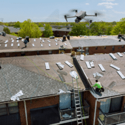
DJI Terra is a mapping and photogrammetry software. It transforms drone data into accurate 2D and 3D models. This software offers real-time mapping, LiDAR optimization, and multispectral analysis for applications in topography, security, and agriculture.
DJI Terra is a photogrammetry and mapping software. It transforms drone data into accurate 2D and 3D models. Ideal for surveying, public safety, agriculture, and emergency services, it simplifies every step.
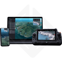
Right from the planning stage, DJI Terra makes it easy to create maps and models with an intuitive interface. In addition, its advanced algorithms generate detailed orthomosaic maps and surface models (DSMs).
Key features :
- Accurate 3D modeling: Creates optimized models without distortion.
- DJI Enterprise compatibility: Perfect for inspections and project management.
- LiDAR optimization: Increased accuracy of point clouds for clear DEM models.
- Multispectral analysis: Uses NDVI and NDRE indices, essential for targeted agriculture.
DJI Terra also offers real-time mapping. This allows each mission to be tracked immediately. In addition, the results can be exported in TIFF, LAS and OBJ formats, for easy integration into GIS and CAD software.
DJI Terra licenses come in several versions. A maintenance subscription is required for perpetual options. Finally, DJI sends the activation code within 72 hours of purchase.
| Version | Agriculture License 1 year (3 devices), Pro License 1 year (1 device), Perpetual Pro License (1 device), Electricity License 1 year (1 device), Annual maintenance and update package, Pro License 1 year (1 device Offline), Perpetual Pro License (1 device Offline), Annual maintenance and update package (Offline), Perpetual Pro License and DJI Modify Standard (1 device), EDU License (10 devices) |
|---|
Only logged in customers who have purchased this product may leave a review.
Related products
Safety and rescue
Available to order (please contact us)
Drone software
Available to order (please contact us)

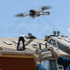
Building and infrastructure inspection
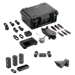
DJI Air 3S Pack with DJI Terra: Roofing, Measurement, and Training
Out of stock

Reviews
There are no reviews yet.