
 Français
 Nederlands
 Deutsch
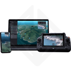
Drone Parts Center offers professional drone software specialized in 2D/3D reconstruction and point cloud generation. Our photogrammetry solutions transform your aerial data into exploitable digital models for mapping, inspection and surveying.
3D Reconstruction Software Solutions
Photogrammetry and 3D Modeling
Our photogrammetry software uses advanced algorithms to convert your drone images into high-precision 3D models. These professional solutions support all 3D reconstruction workflows for technical and industrial applications.
Reconstruction features:
- Automatic reconstruction: Automated image processing with keypoint detection
- Textured 3D models: Mesh generation with photorealistic textures
- Ortho-mosaics: Creation of georeferenced orthophotographic maps
- Digital models: DTM (Digital Terrain Model) and DSM (Digital Surface Model)
Point Cloud Generation
Dense point cloud generation enables precise metric analyses and technical measurements. Our drone software produces high-density point clouds for engineering and metrology applications.
Point cloud characteristics:
- High density: Up to 1000 points/m² depending on image resolution
- Metric precision: Centimeter accuracy with control points
- Automatic classification: Ground, vegetation, buildings, infrastructure
- Standard formats: LAS, LAZ, PLY, XYZ for interoperability
Available Professional Software
Aerial Mapping Solutions
Our mapping software integrates complete tools for aerial image processing, georeferencing and production of cartographic deliverables compliant with professional standards.
Inspection and Analysis Tools
Inspection software includes specialized functionalities for infrastructure analysis, anomaly detection and generation of detailed technical reports.
Workflows and Processing Procedures
Automated Processing Pipeline
Our drone software offers automated workflows optimizing aerial data processing, from image import to final deliverable generation.
Compatibility and Integration
Drone and Sensor Compatibility
Our photogrammetry software supports a wide range of drones and sensors, from compact cameras to professional metric cameras.
Compatible drones:
- DJI: Mavic, Phantom, Inspire, Matrice (all series)
- RGB sensors: Integrated cameras and professional gimbals
- Multispectral sensors: Agriculture and environment
- Metric cameras: High-precision topographic applications
Sectoral Applications
Topography and Surveying
3D reconstruction software revolutionizes topography by enabling fast and precise surveys with automatic generation of topographic plans and volume calculations.
Construction and Site Monitoring
The construction sector uses our drone software for site monitoring, progress control and as-built documentation with integration into BIM processes.
Infrastructure Inspection
Drone inspection combined with our analysis software enables automatic anomaly detection and generation of detailed technical reports.
Precision and Performance
Metric Precision
Our photogrammetry software achieves centimeter precision through use of GPS/RTK control points and optimized processing algorithms.
Training and Technical Support
User Training
Drone Parts Center offers complete training for 3D reconstruction software use, covering theoretical and practical aspects of photogrammetry.
Frequently Asked Questions Drone Software
What precision can I expect with this software?
Precision depends on several factors: image quality, control points, flight altitude. With RTK points, our photogrammetry software achieves 2-5cm absolute precision for topographic applications.
How many images can this software process?
Our 3D reconstruction software handles up to 10,000 images per project. For very large volumes, distributed processing allows calculation distribution across multiple machines.
Customer Service and Delivery
Advice and Selection
Our team advises you in choosing the most suitable photogrammetry software for your applications: mapping, inspection, construction or topography.
Fast Benelux Delivery
Drone Parts Center ensures fast delivery of drone software in Belgium, Netherlands and Luxembourg. Remote installation and user training included.
Transform your aerial data into exploitable models with our 2D/3D reconstruction software. These professional photogrammetry solutions guarantee metric precision and optimized workflows for all your technical applications.
Drone software
Available to order (please contact us)
Drone software
In stock