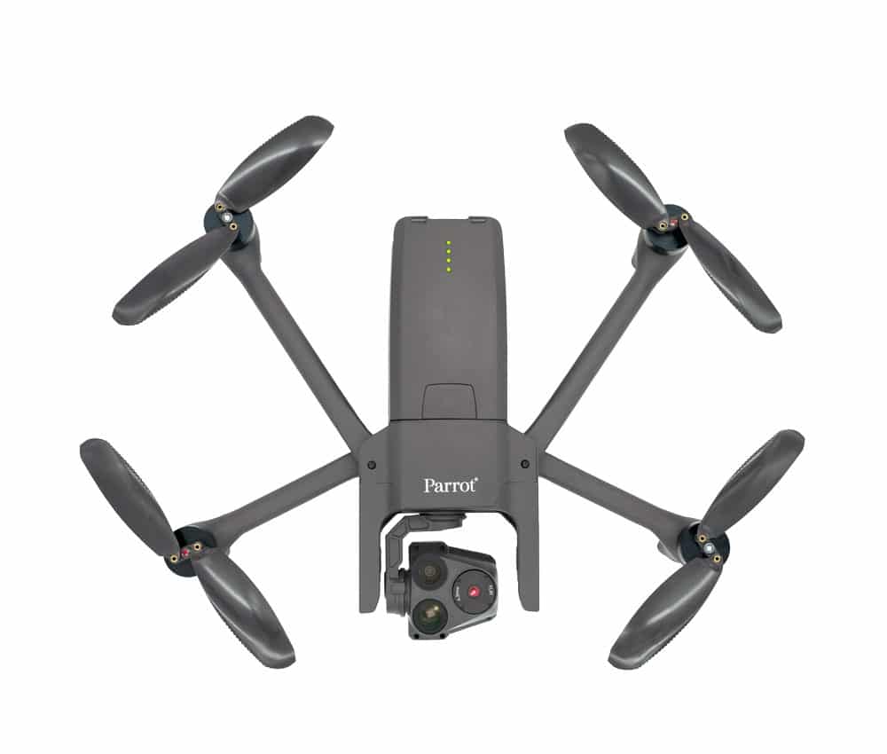
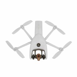
The ANAFI USA model offers the same high-end features – security, endurance, and cutting-edge imaging quality – as the Short-Range Reconnaissance (SRR) drone that Parrot created for the US Army. Its data encryption and privacy functions are in full compliance with the European General Data Protection Regulation (GDPR), thus ensuring the highest level of privacy protection and security for sensitive missions.
ANAFI USA is Parrot’s latest evolution in the development and marketing of innovative professional drone solutions. With over ten years of experience, Parrot has become a trusted name in the drone field, offering its customers unparalleled hardware and software ecosystems. Moreover, its growing list of innovative and experienced industrial partners continues to strengthen and enrich its platform offerings.
32x Zoom
When arriving at an intervention area, firefighters need to see particularly critical zones and get an accurate idea of the overall situation. The optical equipment, gimbal, and advanced lenses of the ANAFI USA drone were designed for this purpose. The 32x zoom is built around two 21-megapixel cameras allowing operators to see the scene in great detail at a maximum distance of 5 km. ANAFI USA can spot details as small as 1 cm from a distance of 50 m, with precision.
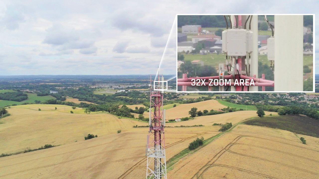
The obtained zoom image is merged with those from ANAFI USA’s FLIR Boson camera. This allows operators to easily spot hot spots using the thermal camera, while distinguishing people on site and any other important details in visible image at a maximum distance of 2 km.
In the example image below, the drone flies over solar panels at an altitude of 40m. Thanks to ANAFI USA’s powerful zoom, the pilot is able to detect heat anomalies present on a specific area of a solar panel, at the centimeter scale.
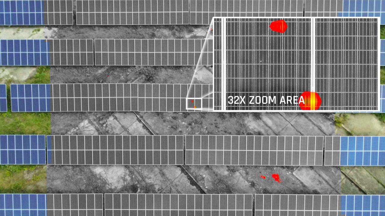
Image stabilization with a 32x zoom represents a real technological challenge on such a light drone (500 g). Parrot has succeeded in meeting this challenge by combining the gimbal with 3-axis digital stabilization, obtained through image processing.
Easy to use
First responder teams and the most demanding professional users need to be able to deploy a drone on site very quickly. To meet this vital constraint, the ANAFI USA drone is operational in less than 55 seconds – including unfolding, powering on, establishing a secure radio connection, and takeoff.
ANAFI USA operates inside a building without GPS, allowing it to take off indoors and then be sent outside through a window, before returning to the starting point once the mission is completed.
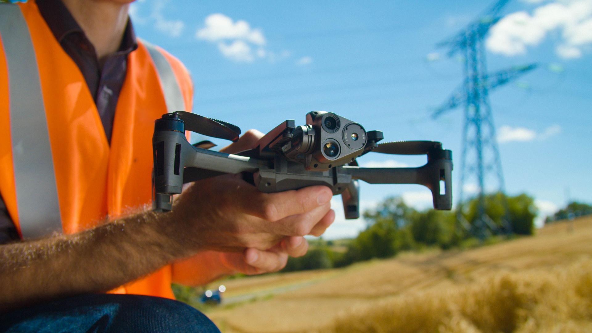
This new drone is so maneuverable that it can also take off from the palm of a hand like a paper airplane.
Natively without a restriction system for no-fly zones, ANAFI USA offers complete freedom to its operators to take off whenever necessary, regardless of the mission, taking responsibility for the area covered.
This drone is the quietest in its category, with a sound level of only 79 dB when it is 50 cm from the ground. When discretion is a key priority of the mission, ANAFI USA offers the ability to fly silently and see incredible details from afar thanks to its 32x zoom.
It operates with a standard USB Type-C charger for total ease of use.
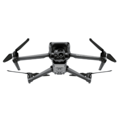
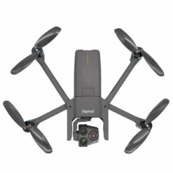
Weighing only 500 g, ANAFI USA is easy to fold for maximum portability. With its very compact small size, it has a flight time of 32 minutes, the best in its category. Moreover, with its 3 batteries included in the pack, ANAFI USA offers a total of 1.5 hours of flight time for a drone weighing less than 1 kg.
Reliable and secure
The ANAFI USA drone puts safety first for professional users.
Photos and videos taken by the drone are stored in an encrypted and ultra-secure manner on its SD (Secure Digital) card, based on an AES-XTS algorithm (512-bit key length), so they cannot be read if the SD card or drone is lost. An encryption key is then the only means to access this data.
ANAFI USA also has a secure connection using the WPA2 protocol between the controller and the drone.
Before updating new firmware, verification of its digital signature is required, which prevents potential attempts at malicious modification of the drone’s software.
Parrot has chosen open standards and protocols (including Wi-Fi, WPA2, RTP/RTSP, H.264, and GUTMA) to ensure trust and interoperability of recorded data.
Users can opt for sharing their data via the FreeFlight 6 application. By default, data is not shared; user consent is necessary. Once this feature is activated and agreement given, flight data and logs are stored on secure servers in Europe, in addition to copies kept locally on the drone. The drone’s features comply with GDPR rules, the European regulation on personal data protection.
Robust
The IP53 rating of the ANAFI USA drone ensures its resistance to dust and its water resistance for flying in rainy weather. It has been designed to withstand the most difficult flight conditions possible encountered during missions.
Image stabilization ensures obtaining very high-quality images, even in wind gusts reaching 15 m/s.
New flight features
ANAFI USA’s advanced flight features are designed to meet the specific requirements of professional drone users. Assisted by FreeFlight 6, Parrot’s proven piloting application, they have a complete suite of flight options. ANAFI USA’s flight plans can be programmed by navigation coordinates, for assisted framing flights or in complete autonomy.
These flight plan programming and object tracking functions are now essential for optimizing ground team coordination.
Thanks to its configurable RTH (Return to Home) function, ANAFI USA allows users to end their flights exactly where they wish. RTH occurs automatically in case of drone disconnection, or when its battery level becomes too low, in order to protect the investment.
ANAFI USA accurately records the satellite coordinates of points of interest that you designate to provide operation managers with a clear view of the terrain and quickly detect missing persons or potential risks.
USE CASE: Power Line Inspection
Power line inspection is a major challenge for electricity companies. Today, most operators use a combination of field personnel and helicopters to inspect their power lines – two operations that are costly, dangerous, and dependent on weather conditions.
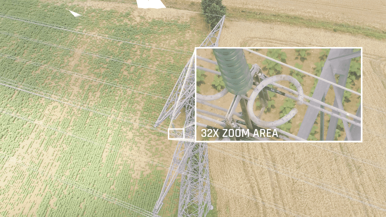
Worldwide, the professional ANAFI USA drone is being rapidly adopted by operators to easily perform equipment inspections.
Its infrared camera allows for unparalleled efficiency in checking insulators.
Its zoom (the most powerful of drones in its category) allows for inspection of high-voltage lines while keeping a safe distance from electric arcs and electromagnetic interference.
It can observe details of 3 mm from a distance of 100 m. Its FLIR Boson infrared camera can identify, locate, and diagnose insulator overheating before its degradation leads to a network outage. Rated IP53, ANAFI USA can be flown in rainy weather. In strong winds, it maintains a stabilized image in gusts up to 15 m/s. ANAFI USA is an easy-to-use tool that deploys in 55 seconds. It weighs 500 g and is retractable. It can take off from and land on the pilot’s hand. It allows for regular inspections. The Flight Plan function allows for very precise planning of 32-minute flights along high-voltage lines and orbiting around pylons.
USE CASE: Solar Panel Inspection
The adoption of renewable energy sources is a major challenge. The proper functioning of solar panels is linked to the quality of their inspection. A single defective cell can compromise the entire system. Manual inspection is a lengthy process. Operators climb high platforms and stop energy production to ensure their safety.
ANAFI USA simplifies the inspection of solar panels.
ANAFI USA uses an integrated FLIR Boson thermal sensor whose definition allows for identifying anomalies at an altitude of 40 m. ANAFI USA can scan 5 rows of solar panels at once. When a hot spot is observed, the drone’s 32x zoom allows for precise identification of the defective cell, with a detail of 3 mm from a distance of 40 m.
All operators can have a retractable drone weighing 500g. Operational in just 55 seconds, it can fly up to 3 km distance. This allows for panel inspection without shutting down the photovoltaic power plant.
Operators also have the option to perform precise flight plans lasting 32 minutes.
Traditional on-foot inspection of a power plant usually requires an operator for several days. With ANAFI USA, this process can be completed more quickly. This saves time and reduces costs.
Once the flight mission is completed, to view thermal images in a geospatial and temporal context, operators can benefit from the interactive video/map player by Survae, Parrot’s partner.
They can also use the FreeFlight 6 application to view videos, modify the range of thermal parameters to isolate an element precisely, and proceed with verification.
USE CASE: Inspection of telecommunication towers
For communication companies with cell phone and radio towers, maintenance and preliminary surveys, which are time-consuming, are a regular and frequent activity.
ANAFI USA eliminates the need for dangerous and time-consuming tower climbing for technicians. Its 32x zoom allows observation of centimeter-level details from 150 m away. Valuable information can be obtained: easily identify equipment serial numbers, confirm permanent installations. ANAFI USA’s zoom also allows the drone to maintain a safe distance from towers to avoid electromagnetic interference, ensuring total safety for operators.
Its FLIR Boson infrared camera can detect hot spots and overheating, thus identifying system failures or even structural damage following a storm.
Having the ability to create accurate 3D modeling with Pix4Dmapper is also a valuable tool allowing operators to comfortably analyze the tower structure, identify equipment needs, in addition to obtaining useful measurements.
IP53 qualified, ANAFI USA is also designed for missions in the harshest flight conditions: it is resistant to rain and dust. Image stabilization ensures obtaining very high-quality images, even in wind gusts reaching 15 m/s.
USE CASE: Police
ANAFI USA has been designed to meet surveillance, search and rescue needs, for critical missions or crime scene exploration. These uses require great discretion from teams during their operations. Its sound signature of 79 dB at 1 m distance makes ANAFI USA undetectable at 130 m. It thus does not trigger any alert that could jeopardize the success of the observation operation.
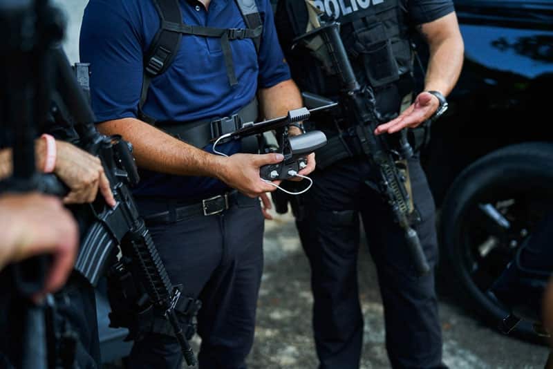
ANAFI USA’s ability to film 1 cm details at 150 m distance, thanks to its x32 zoom, allows it to detect moving people at 2 km during the day. At night, the FLIR Boson® Thermal camera can locate a missing person or potential suspect up to 150 m away.
Once the target is detected, the FreeFlight 6 piloting application allows sharing its exact location with intervention teams.
ANAFI USA is compatible with decision support tools. During a missing person search mission or a fire involving the management of multiple drones, the DroneSense management platform allows for the development, sizing, and management of an ANAFI USA fleet.
Pix4Dcapture and Pix4Dmapper software allow for rapid 3D mapping of an accident scene to safely reopen a road. Pix4Dreact enables offline mapping of a search area to detect, in collaborative mode, points of interest where to send the drone for reconnaissance.
ANAFI USA weighs 500 g. Its deployment takes 55 seconds. These assets make it easy to deploy in any envisaged situation. It thus allows law enforcement to save time and money.
Its secure Wi-Fi connection and robust SD card encryption with the AES-XTS algorithm associated with a 512-bit encryption key make ANAFI USA usable for the most confidential missions. Manufactured in the United States, ANAFI USA fully complies with TAA (Trade Agreement Act) and NDAA (National Defense Authorization Act) regulations and can be purchased through the 2020 GSA Schedule.
Technical Specifications
EO (ELECTRO-OPTICAL) IMAGE STREAM
- 2 sensors: 1/2.4”
- Digital zoom: x32
- Electronic shutter speed: 1 s to 1/10000s
- ISO range: 100-3200
- Video resolution: 4K/FHD/HD
- Video format: MP4 (H.264)
- Photo resolution: Wide: 21MP (field of view: 84°); Rectilinear: up to 16MP (for a field of view of 75.5°)
- Photo formats: JPEG, DNG (Digital NeGative RAW)
IR (INFRARED) IMAGE STREAM
- Sensor: FLIR BOSON
- Resolution: 320×256
- Detection range: -40°C to +150°C
- Thermal sensitivity: <60mK
- Photo format: JPEG
- Video format: MP4 (H.264)
- Video output resolution: 1280×720, 9 fps
IMAGE STABILIZATION
- Stabilized IR/EO gimbal:
- Hybrid: 3 axes
- Mechanical: 2 axes – roll / pitch
- Electronic (EIS): 3 axes – yaw / roll / pitch
- Gimbal orientation: -140° to +110°
SENSORS
- Satellite navigation: GPS, GLONASS & GALILEO
- Barometer and magnetometer
- Vertical camera and ultrasonic sensor
- 2 6-axis inertial measurement units
- 2 3-axis accelerometers
- 2 3-axis gyroscopes
ANAFI USA DRONE
- Folded size: 252 x 104 x 82 mm
- Unfolded size: 282 x 373 x 84 mm
- Weight: 500 g
- Maximum transmission range: 4 km with Parrot Skycontroller 3
- Maximum flight time: 32 minutes
- Maximum horizontal speed: 14.7 m/s (52.92 km/h)
- Maximum vertical speed: 6 m/s (21.60 km/h)
- Wind resistance: 14.7 m/s (52.92 km/h)
- Service ceiling: 6,000 m MSL (above sea level)
- Geographical and altitude limitations can be disengaged
- Operating temperature: -35 °C to 43 °C
- No temperature limitation at take-off
- Fully private data management between the drone and the terminal OR anonymous sharing on secure European servers
SMART BATTERY WITH FAST CHARGING
- Type: High-density LiPo (3 cells of 4.4 V)
- Capacity: 3400 mAh
- Flight time: 32 minutes
- Charging: USB-C
- 2-hour charge with a USB-PD (Power Delivery) charger – not included
- 3 hours 20 minutes charge with the fast charging port of the provided charger
- Weight: 195 g
- Voltage: 11.55 V
- Maximum charging power: 30 W
PARROT SKYCONTROLLER 3
- Folded size: 94 x 152 x 72 mm
- Unfolded size: 153 x 152 x 116 mm
- Weight: 283 g / 0.62 lb
- Transmission system: Wi-Fi 802.11a/b/g/n
- Operating frequencies: 2.4 – 5.8 GHz
- Maximum range: 4 km
- Live video stream resolution: 720p (HD)
- Battery capacity: 2500 mAh 3.6 V
- Battery charging time: 2h30 (Android) / 5h30 (iOS)
- Supported mobile devices: screens up to 6.5″
- USB ports: USB-C (charging), USB-A (connection)
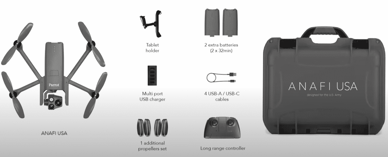
Product contents
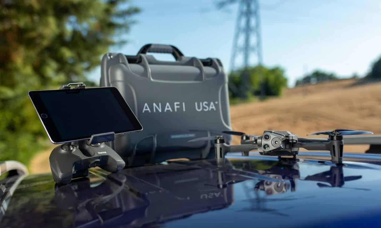
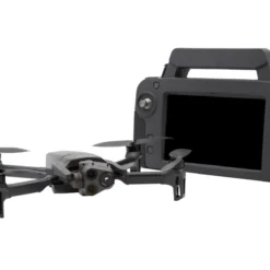
- 1 x Parrot Anafi USA Drone
- 1 x Skycontroller 3 Remote Control
- 1 x Tablet holder for remote control
- 3 x Batteries
- 1 x USB multi-port charger
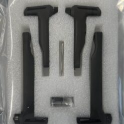
- 1 x Set of spare propellers
- 4 x Connection cables
- 1 x Hard carrying case


Reviews
There are no reviews yet.