News
Using the Walcors RTK Network for Professional Drones
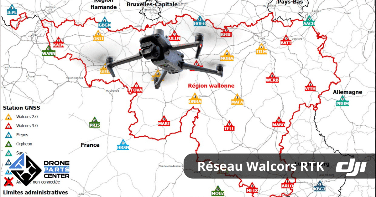
The Walcors RTK professional drone network offers free access to centimetric GPS accuracy, essential for demanding missions in Wallonia. Comprising 23 interconnected stations, it also integrates with networks covering Flanders and Brussels, guaranteeing nationwide coverage.
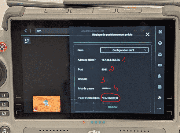
To access this service, download and complete the form available on the official registration pageand send it to gnss@spw.wallonie.be. You will receive an email containing :
- A server IP address (NTRIP)
- One connection port
- A username and password
Once configured, your drone, like the DJI Matrice 350 RTK, will be able to take full advantage of the Walcors network for applications such as 3D mapping, agricultural surveillance orindustrial inspection.
Why choose Walcors for your professional drones?
The local corrections provided by the “NEAR32GREC” mounting point make it possible to achieve exceptional accuracy, ideal for :
- Infrastructure inspection: Efficiently diagnose bridges, roads and buildings.
- Agricultural mapping: Get detailed orthomosaics to monitor your crops.
- Search and rescue: Quickly locate critical areas in case of emergency.
Simplified configuration
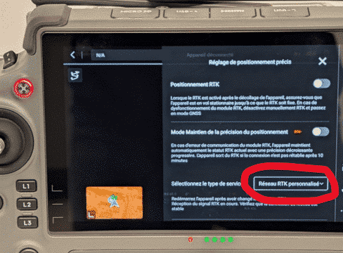
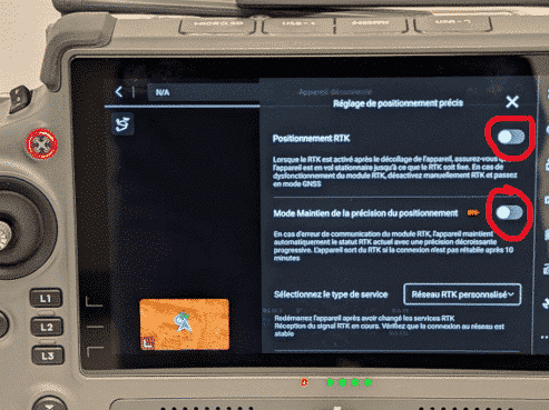
Your remote control must be connected to the internet via a hotspot, Wi-Fi network, or dedicated modem. Follow the steps given below to enable the custom RTK mode and enter the received information.
Real-world applications with Walcors RTK
- 3D photogrammetry: ideal for architectural and modeling projects.
- Agricultural monitoring: Analyze plant health and optimize your yields.
- Industrial missions: Plan reliable inspections on complex sites.
For further details on mounting points and configurations, visit the dedicated page.
Suggested internal links :
- Discover the DJI Matrice 350 RTK for complex missions.
- DJI Mavic 3 Enterprise user guide for inspection.
- DJI Dock 2: Optimize your automated missions.
