

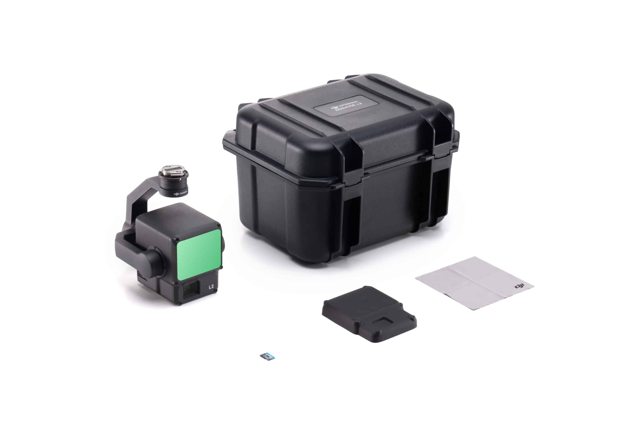
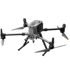
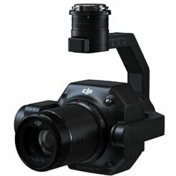
DJI Zenmuse L2
€ 12.989,00
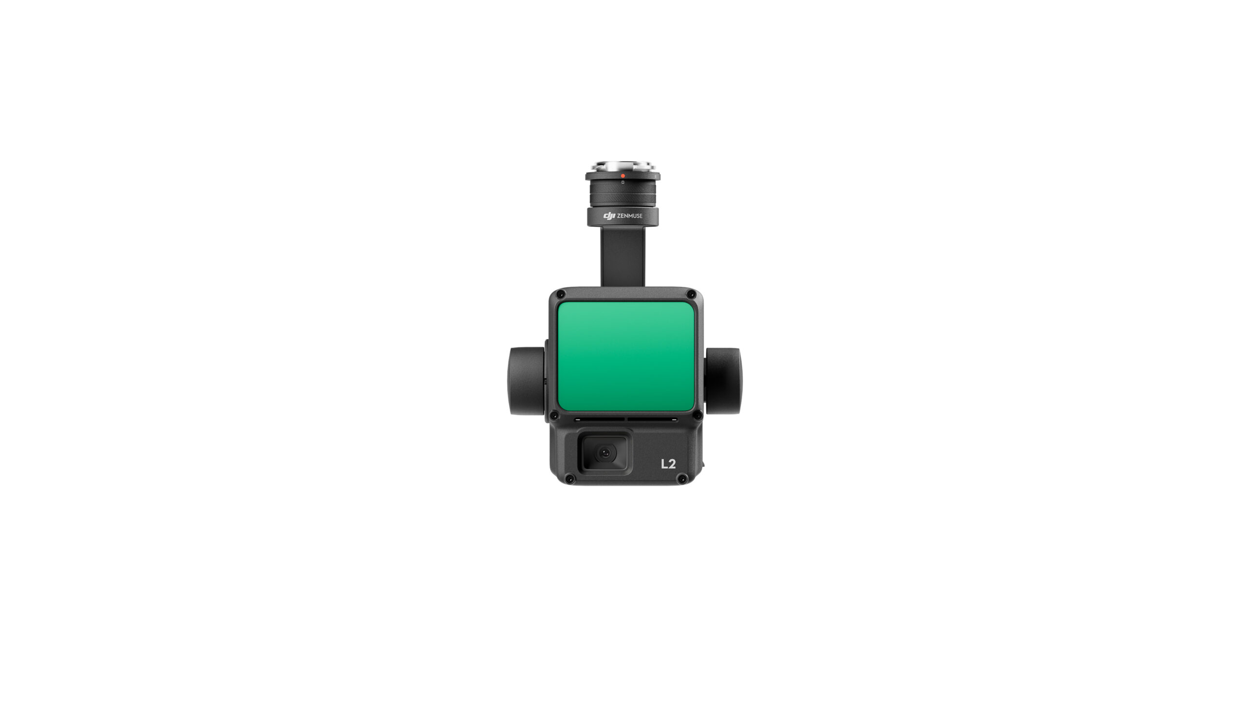
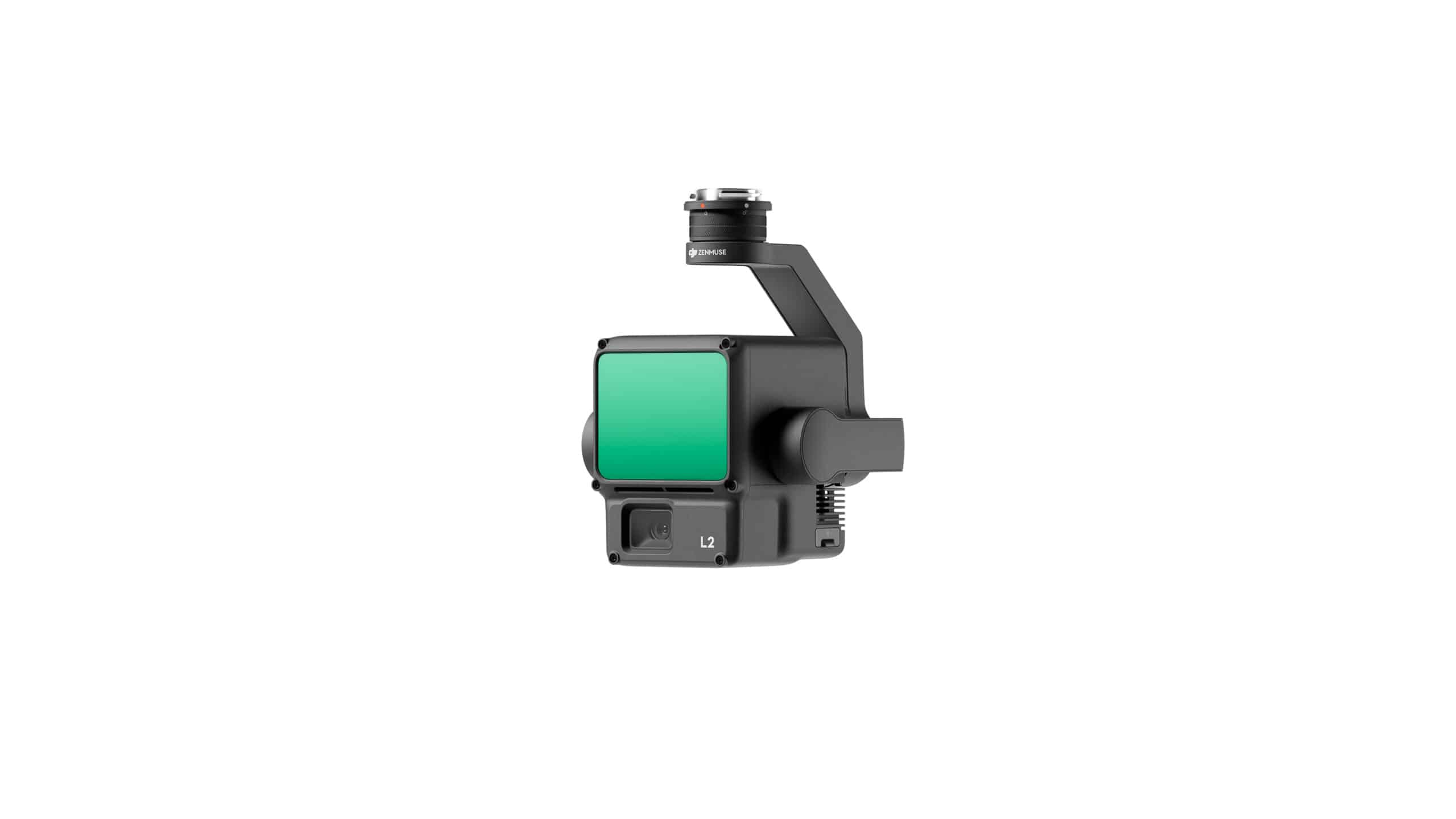
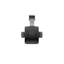
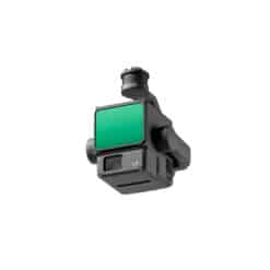
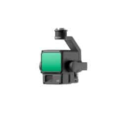
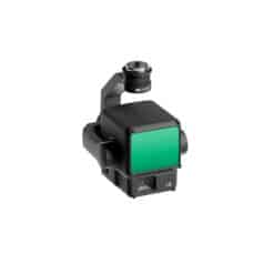
The DJI Zenmuse L2 is the pinnacle of LiDAR technology. With its 4/3 CMOS RGB camera, Livox LiDAR module and precision IMU, it delivers detailed 3D scans. Able to penetrate dense vegetation and detect objects at 250 meters, it's the ideal tool for surveying, mapping and more. Instant start-up and advanced features make it a must-have for professionals.
Available to order (Please contact us)
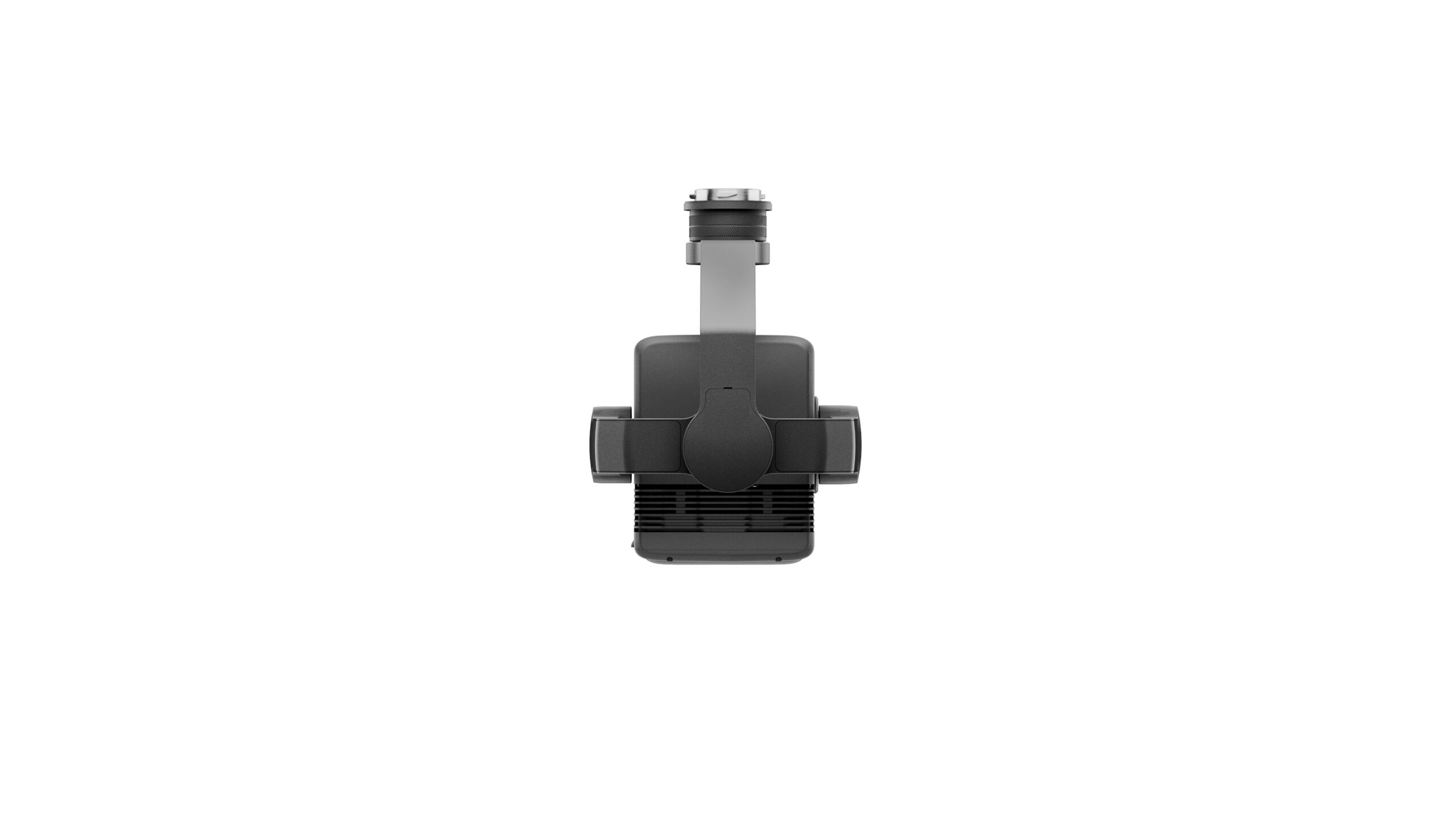
Incorporating the power of the latest LiDAR system, the DJI Zenmuse L2 is a revolution in precise 3D data collection. It features a 4/3 CMOS RGB mapping camera, a Livox LiDAR module and a high-precision IMU. Thanks to its 3-axis stabilized gondola, it guarantees exceptionally sharp scans. What's more, its ability to cover an extended radius enables it to generate point clouds with impressive speed.
The Zenmuse L2's efficiency is evident in its ability to detect minute objects at considerable distances, even through dense vegetation. As a result, the digital elevation models it produces are of unrivalled accuracy. What's more, its support for up to 5 returns enhances its accuracy on bare ground, while its two scanning modes make it invaluable for state-of-the-art topographic surveys.
One of the greatest strengths of this technology is its instant start-up capability. As soon as it is powered up, Zenmuse L2 is ready to collect valuable data, both LiDAR and photogrammetric. And with the support of GNSS and the internal IMU, it guarantees vertical accuracy of 4 cm and horizontal accuracy of 5 cm.
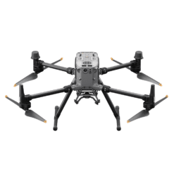
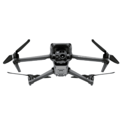
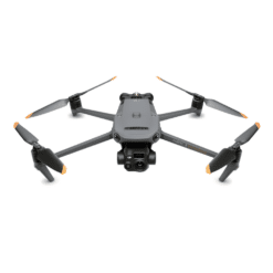
Operating in symbiosis with the Matrice 350 RTK and DJI Terra, the Zenmuse L2 is an all-in-one solution for professionals in a wide range of fields, including surveying, mapping, energy, forestry and construction. In short, whether for its accuracy, portability or ease of use, the DJI Zenmuse L2 redefines the standards of modern mapping.
Contents:
| General | |
|---|---|
| Product Name | Zenmuse L2 |
| Dimensions | 155 x 128 x 176 mm (L x W x H) |
| Weight | 905 ± 5 g |
| Power supply | 28 W (standard) 58 W (max.) |
| Protection class | IP54 |
| Compatible devices | 300 RTK matrix (DJI RC Plus required) Matrix 350 RTK |
| Storage temperature | -20 to 60° C |
| LiDAR | |
|---|---|
| Measurement accuracy (RMS 1σ) | 2 cm at 150 m |
| Maximum returns supported | 5 |
| Scanning modes | Non-repetitive scan model, repetitive scan model |
| FOV (field of view) | Repetitive scan patterns: 70° (horizontal), 3° (vertical) Non-repetitive scan patterns: 70° (horizontal), 75° (vertical) |
| Min. detection range | 3 m |
| Laser beam divergence | 0.2 mrad (horizontal), 0.6 mrad (vertical) |
| Laser wavelength | 905 nm |
| Laser spot size | 4 cm (horizontal), 12 cm (vertical) at 100 m (FWHM) |
| Laser pulse emission frequency | 240 kHz |
| Laser safety | Class 1 (IEC 60825-1:2014) |
| Accessible emission limit (AEL) | 233.59 nJ |
| Reference opening | Effective aperture: 23.85 mm (equivalent to a circular aperture) |
| Max. laser pulse power within 5 nanoseconds | 46,718 W |
| Sensor | |
|---|---|
| CMOS 4/3, effective pixels | 20 MP |
| Objective | FOV: 84 24 mm equivalent Aperture: f/2.8 to f/11 Focus points: 1 m to ∞ (with autofocus) |
| Shutter speed | Mechanical shutter: 2 to 1/2,000 s Electronic shutter: 2 to 1/8,000 s |
| Number of shutters | 20 0000 |
| Photo ratio | 5 280 x 3 956 (4:3) |
| Still photography modes | Single shot: 20 MP Interval: 20 MP JPEG time interval: 0.7/1/2/3/5/7/10/15/20/30/60 s RAW/JPEG + RAW time interval: 2/3/5/7/10/15/20/30/60 s |
| Video codec and resolution | H.264 4K: 3,840 x 2,160 at 30 fps FHD: 1,920 x 1,080 at 30 fps |
| ISO | Video: 100 to 6,400 Photo: 100 to 6,400 |
| Video bit rate | 4K: 85 Mb/s FHD: 30 Mb/s |
| Supported system files | exFAT |
| Photo format | JPEG/DNG (RAW) |
| Video formats | MP4 (MPEG-4 AVC/H.264) |
| Nacelle | |
|---|---|
| Stabilization system | 3 axes (tilt, roll, pan) |
| Angular vibration range | 0,01° |
| Assembly | DJI SKYPORT detachable |
| Mechanical amplitude | Tilt: -143° to +43 Pan: ± 105 |
| Adjustable range | Tilt: -120 to +30 Pan: ± 90 |
| Operating mode | Follow/Liberate/Recenter |
| Data storage | |
|---|---|
| Raw data storage | Photo/IMU/Point Range/GNSS/Calibration files |
| Point cloud data storage | Real-time modeling data storage |
| Supported microSD cards | microSD: sequential write speed of 50 Mb/s or higher and UHS-I class 3 or higher. Max. capacity 256 GB. microSD cards recommended. |
| Recommended microSD cards | Lexar 1066x 64 GB U3 A2 V30 microSDXC Lexar 1066x 128 GB U3 A2 V30 microSDXC Kingston Canvas Go! Plus 128 GB U3 A2 V30 microSDXC Lexar 1066x 256 GB U3 A2 V30 microSDXC |
| Post-processing | |
|---|---|
| Supported software | DJI Terra |
| Data format | DJI Terra supports the export of point cloud models in the following formats: PNTS/LAS/PLY/PCD/S3MB |
Only logged-in customers who have purchased this product can leave a review.
Similar products
DJI Enterprise
Available to order (Please contact us)
DJI Enterprise
Available to order (Please contact us)
Available to order (Please contact us)
Agriculture and agri-food
Available to order (Please contact us)
DJI Enterprise
Available to order (Please contact us)
Mapping
Available to order (Please contact us)
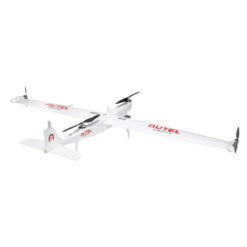
Autel Robotics
Available to order (Please contact us)
SDK and development
2 in stock
Notice
There's no notice yet.