
 Français
 Nederlands
 Deutsch
News
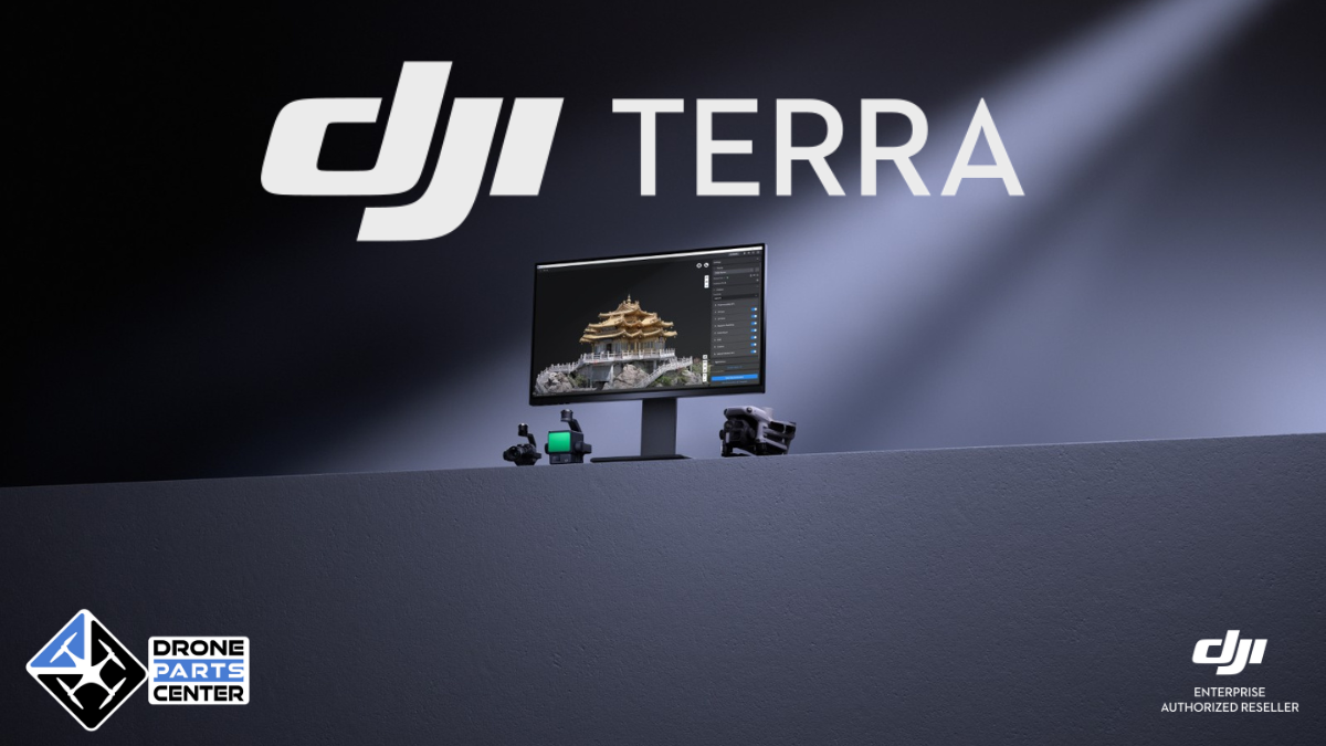
DJI Terra V5.0: The Gaussian Splatting Revolution Transforms Drone 3D Modeling
Jul
The aerial mapping industry has just reached a milestone with the launch of DJI Terra V5.0, a revolutionary update that integrates Gaussian Splatting technology into consumer 3D reconstruction software for the first time. This major technological advancement, announced on July 17, 2025, marks the culmination of seven years of continuous innovation since the launch of the first version of DJI Terra in 2018.
The new DJI Terra version 5.0 doesn’t just improve existing features—it literally revolutionizes the way professionals in mapping, architecture, engineering, and many other industries create photorealistic 3D models from drone-captured imagery. With double the processing performance of previous versions and unprecedented visual quality, this update positions DJI as the undisputed market leader in aerial 3D reconstruction.
For professionals who are already using DJI Terra or considering adopting it, version 5.0 is much more than just an update—it’s a complete transformation of their workflow. The promised productivity gains, combined with enhanced hardware accessibility and new “truly permanent” licensing models, make this release a strategic turning point for the entire DJI Enterprise ecosystem.
This comprehensive analysis will guide you through all the innovations in DJI Terra V5.0, from the technical underpinnings of Gaussian Splatting, to practical applications in your industry, to economic considerations and purchase recommendations to maximize your return on investment.
DJI Terra V5.0: The Evolution of a Benchmark Software
DJI Terra V5.0 represents the culmination of seven years of continuous development in the field of 3D aerial reconstruction. Initially launched in 2018 with version 1.0, this 3D modeling software has constantly evolved to meet the growing needs of professionals in mapping, architecture, engineering, and many other industries.
DJI Terra’s philosophy is based on an integrated hardware-software approach that fundamentally sets this solution apart from its competitors. Unlike general-purpose photogrammetry software, DJI Terra has been specifically designed to make the most of the capabilities of DJI Enterprise drones, creating a cohesive ecosystem where each component is optimized to work in perfect synergy with the others.
The timeline evolution of DJI Terra is a perfect example of this incremental approach to innovation. Version 2.0, launched in 2019, introduced support for advanced 3D reconstruction, allowing users to create their first professional-quality three-dimensional models. Version 3.0 of 2021 marked a turning point with the integration of LiDAR support, paving the way for more accurate reconstructions in complex environments. Version 4.0 of 2024 then introduced DJI Modify, a 3D model editing tool that completed the ecosystem by enabling advanced data post-processing.
Now, DJI Terra V5.0 is taking another decisive step forward with the integration of Gaussian Splatting, a cutting-edge technology that was previously reserved for research labs and highly specialized applications. This democratization of disruptive technology is part of DJI’s strategy to make tools that were previously out of reach, both technically and economically, accessible to professionals.
DJI Terra V5.0’s positioning in the market is particularly strategic. While most competing solutions focus on either ease of use at the expense of quality or technical performance over accessibility, DJI Terra V5.0 manages to reconcile these two seemingly contradictory requirements. This balanced approach largely explains the commercial success of the solution and its growing adoption in sectors as varied as urban planning, heritage preservation, civil engineering and precision agriculture.
Version 5.0 also introduces a new business philosophy with the concept of “Truly Permanent” licenses, which addresses the legitimate concerns of business users about the sustainability of their software investments. This approach, combined with the outstanding technical performance of Gaussian Splatting, positions DJI Terra V5.0 as a future-proof solution that can support professionals in their digital transformation over the long term.
The Gaussian Splatting Revolution: A Disruptive Technology Explained
Gaussian Splatting is arguably the most significant innovation in DJI Terra V5.0, and for good reason: this revolutionary technology radically transforms the way 3D models are created from aerial imagery. To understand the magnitude of this advance, it is essential to grasp the fundamental principles that distinguish Gaussian Splatting from traditional reconstruction methods.
Unlike classical photogrammetry which generates meshes composed of interconnected triangles, Gaussian Splatting uses a fundamentally different approach based on Gaussian ellipsoids. Each ellipsoid is defined by fourteen specific parameters: three spatial coordinates (X, Y, Z) for position, four rotation parameters for orientation, three scale parameters for size, three color parameters for appearance in different lighting, and an opacity parameter for transparency.
This sophisticated mathematical representation allows Gaussian Splatting to overcome the traditional limitations of photogrammetry, particularly in the rendering of complex elements. Where conventional methods struggle to faithfully render reflective surfaces, transparent materials, dense vegetation, or delicate structures, Gaussian Splatting excels in creating continuous, fluid representations that preserve all visual details.
The most spectacular advantage of Gaussian Splatting is its real-time rendering capability. Unlike traditional mesh models that require complex calculations for each change in point of view, Gaussian ellipsoids can be rendered instantly from any angle, creating an immersive experience comparable to that of a modern video game. This fluidity opens up new possibilities for project presentation, training, predictive maintenance and many other applications.
Processing performance is another major strength of Gaussian Splatting in DJI Terra V5.0. With a processing capacity of about 500 images per hour, the software can now reconstruct an entire urban city block in just 30 to 40 minutes. For large-scale projects exceeding 10,000 images, benchmarking shows that the Gaussian Splatting workflow is twice as fast as the traditional Terra Mesh pipeline, representing a significant productivity boost for professionals.
This remarkable efficiency is accompanied by intelligent optimization of material resources. DJI Terra V5.0 can process between 300 and 400 images per gigabyte of available RAM, allowing a computer with 32 GB of RAM to handle up to 30,000 images in a single task. This optimization democratizes access to Gaussian Splatting by making this cutting-edge technology accessible on relatively modest hardware configurations.
The impact on visual quality is equally impressive. Gaussian Splatting generates orthomosaics that are completely free of distortions, a recurring problem with traditional methods, especially in dense urban areas or complex architectural environments. This geometric precision, combined with photorealistic rendering, produces digital twins of exceptional fidelity that find immediate applications in urban planning, heritage preservation, and project communication.
The flexibility of output formats is another strategic advantage of Gaussian Splatting in DJI Terra V5.0. The software natively supports export to 3DTiles (Cesium compatible), Universal PLY, and GeoTIFF formats for GIS applications, ensuring seamless integration with existing workflows and third-party platforms used in different industries.
Performance and technical capabilities: figures that speak for themselves
DJI Terra V5.0’s performance marks a quantum leap over previous versions, with measurable improvements that are transforming the user experience and productivity of frontline workers. Detailed analysis of the benchmarks reveals performance gains that far exceed market expectations.
The processing speed is the most dramatic improvement in this new version. With a processing capacity of approximately 500 frames per hour on a standard configuration, DJI Terra V5.0 sets new performance standards in the industry. To put this performance into perspective, a typical urban mapping project with 1,500 images can now be processed in less than three hours, compared to six to eight hours with previous versions using traditional mesh technology.
Large-scale projects benefit from even more significant improvements. Testing on datasets exceeding 10,000 images demonstrates that the Gaussian Splatting workflow achieves twice the processing speeds of the Terra Mesh pipeline. This improvement is particularly valuable for smart city projects, extensive infrastructure mapping, or large-scale environmental monitoring, where processing times are often a limiting factor.
Optimizing hardware resources is another remarkable aspect of DJI Terra V5.0. The software has been designed to maximize the use of available RAM, with a processing capacity of 300 to 400 frames per gigabyte of RAM. This optimization allows a workstation equipped with 64 GB of RAM to comfortably handle projects from 20,000 to 25,000 images, covering urban areas of several square kilometers.
The minimum hardware requirements have been deliberately kept at an accessible level to democratize access to Gaussian Splatting. A configuration with 32 GB of RAM and an NVIDIA graphics card with 4 GB of video memory is enough to fully exploit the software’s basic capabilities. This affordability contrasts favorably with other solutions on the market that require considerable hardware investments to achieve comparable performance.
For organizations with larger resources, DJI Terra V5.0 leverages high-end configurations to deliver exceptional performance. A workstation equipped with 128 GB of RAM can process up to 40,000 images in a single task, allowing the reconstruction of entire urban areas or extensive industrial sites. NVIDIA RTX 30 series and above graphics cards benefit from specific optimizations that further accelerate Gaussian Splatting calculations.
The LiDAR reconstruction has also received substantial improvements in version 5.0. Processing speeds for generating 2D maps from LiDAR data have been improved by 20 to 50 percent depending on hardware configuration and data volume. This improvement is particularly useful for applications such as infrastructure inspection, forest monitoring, or mapping hard-to-reach areas.
The integration of the D-RTK 3 system with PPK (Post-Processed Kinematic) capabilities ensures centimeter accuracy even in environments where RTK signals are not available. This technical robustness ensures reliable results in all field conditions, a crucial aspect for demanding professional applications.
Clustered processing capabilities have been preserved and optimized for organizations with massive processing needs. A cluster of five workstations can now process 30,000 images in just 21 hours, compared to days with traditional methods. This scalability allows large organizations to process large volumes of data while maintaining delivery times that are compatible with operational requirements.
Practical applications and use cases: Transforming industries
DJI Terra V5.0 with Gaussian Splatting opens up new application opportunities across multiple industries, transforming established workflows and creating new business opportunities. Analysis of early deployments reveals productivity and quality gains that exceed initial user expectations.
Urban mapping and smart cities
Urban mapping represents one of the most promising areas of application for DJI Terra V5.0. The photorealistic reconstruction capabilities of Gaussian Splatting make it possible to create urban digital twins of exceptional fidelity, seamlessly integrating architectural details, signage, urban vegetation and even street furniture elements.
Municipalities are now using these 3D models to optimize urban planning, simulate the visual impact of new development projects, and improve communication with citizens. The templates allow city planners to visualize the impact of future renovation projects in a level of detail that was previously impossible to achieve.
Urban infrastructure management also benefits from these technological advances. Municipal technical services can now perform detailed virtual inspections of public buildings, bridges, and transportation networks, significantly reducing physical inspection costs while improving diagnostic accuracy.
Heritage preservation and archaeology
The heritage preservation industry finds in DJI Terra V5.0 a revolutionary tool for the documentation and conservation of historic sites. The millimeter resolution achievable with drones like the DJI Matrice 4E captures architectural details with extraordinary precision, creating a future-proof digital archive that will survive natural degradation or disaster.
The generated 3D models not only make it possible to plan restoration work with unparalleled precision, but also to create immersive virtual tour experiences that enrich the tourist offer.
Archaeological applications are particularly promising. Archaeological excavations can now be documented continuously, creating a complete 3D history of the evolution of the discoveries. This approach revolutionizes archaeological research by allowing researchers from all over the world to collaborate on shared 3D models, significantly speeding up the analysis and interpretation processes.
Engineering and construction
The construction industry is rapidly adopting DJI Terra V5.0 to optimize project management and improve communication between stakeholders. Photorealistic 3D models make it possible to monitor the progress of the work with exceptional temporal and spatial precision, facilitating the early detection of deviations from the initial plans.
Construction companies use these models to optimize site logistics, plan the interventions of the various trades, and communicate effectively with project owners. Feedback shows a significant reduction in project delays thanks to better anticipation of potential problems.
The inspection of engineering structures also benefits from these advances. Bridges, dams, and other critical infrastructure can be inspected in a non-intrusive manner, generating detailed 3D models that allow engineers to identify areas in need of preventative maintenance.
Precision Agriculture and Environmental Monitoring
Precision agriculture finds in DJI Terra V5.0 advanced analytics tools that transform farm management. The software’s multispectral capabilities enable the generation of vegetation maps (NDVI, NDRE) with exceptional accuracy, optimizing input application and maximizing yields while reducing environmental impact.
Winegrowers use these technologies to optimize plot management, accurately identifying areas in need of specific interventions. The approach allows for a differentiated application of treatments according to the specific needs of each area of the vineyard.
Environmental monitoring is also benefiting from these advances. Environmental organizations use DJI Terra V5.0 to monitor ecosystem changes, detect vegetation changes, and assess the impact of human activities on natural environments. This approach allows for more proactive and scientifically based management of protected areas.
Energy sector and infrastructure
The energy industry is massively adopting DJI Terra V5.0 for the inspection and maintenance of critical infrastructure. High-voltage power lines, wind farms, and solar installations can be systematically inspected, generating 3D models that help identify potential faults before they cause failures.
Feedback shows a significant improvement in the effectiveness of preventive inspections. The generated 3D models allow technicians to plan maintenance interventions with unparalleled accuracy, significantly reducing downtime and operational costs.
Oil and gas facilities also benefit from these technologies for safety monitoring and maintenance planning. DJI Terra V5.0’s ability to process large amounts of LiDAR data enables the creation of accurate 3D models of complex facilities, facilitating risk management and industrial process optimization.
Drone compatibility and DJI ecosystem: a perfect integration
One of the major strengths of DJI Terra V5.0 is its native integration with the DJI Enterprise ecosystem, creating a seamless workflow from data capture to delivery of the finalized 3D models. This integrated approach fundamentally sets DJI Terra apart from its competitors and is a big reason for its success with professionals.
Compatible DJI Drones and Specific Optimizations
The DJI Matrice 4E is the go-to platform for fully exploiting the capabilities of DJI Terra V5.0. This professional drone, specifically designed for aerial mapping, incorporates hardware and software optimizations that maximize the quality of the data captured for Gaussian Splatting. Its high-resolution camera system, combined with the integrated RTK module, ensures exceptional geometric accuracy that directly translates into better quality of the generated 3D models.
The Matrice 400 series, although predating the Matrice 4E, remains fully compatible with DJI Terra V5.0 and benefits from the performance improvements brought by Gaussian Splatting. Users who already own these platforms can therefore migrate to version 5.0 without additional hardware investment, while benefiting from substantial productivity improvements.
The Matrice 30 series drones, including the 30T and 30TD variants, are now officially supported by DJI Terra V5.0, significantly expanding the potential user base. This extensive compatibility allows teams using these versatile platforms to benefit from the advancements of Gaussian Splatting for their mapping and inspection missions.
Integration with specialized sensors
The Zenmuse P1 sensor, specially designed for professional photogrammetry, finds in DJI Terra V5.0 an ideal partner to fully exploit its capabilities. This 45-megapixel full-frame sensor, equipped with a 3-axis mechanical shutter, captures images of exceptional quality that result in strikingly realistic Gaussian Splatting models.
The integration of Zenmuse L2, a next-generation LiDAR sensor, combines the advantages of Gaussian Splatting for visible surfaces with the precision of LiDAR for obscured or hard-to-reach areas. This hybrid approach opens up new perspectives for mapping complex environments such as dense forests, urban areas with many masks, or industrial sites with multiple levels.
Multispectral sensors, essential for agricultural and environmental applications, also benefit from the optimizations of DJI Terra V5.0. The generation of NDVI and NDRE vegetation maps is now done with greater speed and accuracy, allowing farmers and managers of natural areas to make more informed decisions.
Integrated workflow with DJI Modify
The integration between DJI Terra V5.0 and DJI Modify is one of the most innovative aspects of the DJI Enterprise ecosystem. This synergy allows for a seamless transition of Terra-generated 3D models to Modify’s advanced editing environment, creating a complete workflow from capture to final delivery.
DJI Modify, included in version 1.4.0 with DJI Terra V5.0, brings sophisticated editing features specially optimized for Gaussian Splatting models. Users can perform smoothing, noise reduction, downsampling, and classification operations directly on 3D models, without loss of visual quality.
This integration also facilitates the generation of specialized deliverables according to industry needs. Models can be exported to industry standard formats (GIS, CAD, BIM), allowing seamless integration into the existing workflows of design offices, local authorities, and construction companies.
D-RTK 3 positioning system and accuracy
The D-RTK 3 system, a next-generation RTK base station, integrates seamlessly with DJI Terra V5.0 to ensure centimeter accuracy of the generated models. This exceptional accuracy is crucial for demanding professional applications such as cadastral mapping, inspection of civil engineering structures, or deformation monitoring.
Built-in Post-Processed Kinematic (PPK) capabilities make it possible to achieve this accuracy even in environments where RTK signals are not available, such as dense urban areas or remote sites. This technical robustness ensures the reliability of the results in all operational conditions.
The cloud integration for PPK processing, available in mainland China, exemplifies DJI’s innovative approach to simplifying complex workflows. This feature allows users to benefit from high-precision positioning corrections without requiring extensive technical expertise in geodesy.
Future developments and roadmap
DJI continues to enrich the Terra ecosystem with regular updates that expand compatibility and improve performance. The product roadmap includes the integration of new specialized sensors, optimization for future generations of DJI drones, and the development of advanced features specifically designed to exploit the unique capabilities of Gaussian Splatting.
This continuous improvement approach ensures that DJI Terra V5.0 users will receive a sustainable return on investment, with features that are constantly evolving to meet emerging market needs and technological innovations.
New licensing models and the “Truly Permanent” strategy
DJI Terra V5.0 introduces a revolution in business strategy with the concept of “Truly Permanent” licensing, addressing the legitimate concerns of professionals about the sustainability of their software investments. This approach marks a departure from the recurring subscription models that dominate the market and positions DJI as a long-term partner for its customers.
Range of Licenses Available
The new pricing structure for DJI Terra V5.0 is built around five distinct versions, each tailored to specific needs and different budgets. This segmentation allows users to choose the solution that best suits their business requirements without paying for extraneous features.
The Agriculture version, specifically designed for agricultural professionals, integrates all the features needed for precision agriculture, including the generation of NDVI and NDRE vegetation maps, the creation of variable prescription maps, and the optimization of flight plans for DJI Agras spraying drones. This version comes with preferential pricing and bundles with the purchase of DJI agricultural drones.
The Standard version represents the entry point for mapping and inspection professionals. It includes classic photogrammetry features, basic LiDAR support, and access to measurement and annotation tools. Although it does not have Gaussian Splatting, this version is still perfectly suited to the needs of many professional users.
The Flagship version is the premium offering of DJI Terra V5.0, integrating all advanced features including Gaussian Splatting, advanced LiDAR processing, full multispectral capabilities, and priority access to new features. This version is aimed at demanding professionals who want to take full advantage of the software’s cutting-edge capabilities.
“Truly Permanent” Strategy and Implications
The concept of “truly permanent” licenses represents a paradigmatic shift in the professional software industry. Unlike subscription models that generate unpredictable recurring costs, DJI Terra V5.0 perpetual licenses allow organizations to control their software budgets over the long term.
This approach comes with the removal of offline upgrade packages, greatly simplifying licensing for users. Perpetual license holders automatically benefit from minor updates and bug fixes, ensuring an optimal level of service with no hidden costs.
The refund policy put in place for former “DJI Terra Upgrade and Maintenance Fee” holders is a testament to DJI’s commitment to its existing customers. All historical orders that have not been activated since 2021 can be refunded until August 31, 2025, allowing users to migrate to the new licensing model without financial penalty.
Trial and discovery options
DJI Terra V5.0 offers a particularly generous free trial program, allowing new users to experience the capabilities of the Gaussian Splatting for a full month. This evaluation period, which can be accessed via a request on the official DJI Terra website, includes access to all features of the Flagship version, with some limitations on the volume of data that can be processed.
Users who have already had a free trial of previous versions can renew their request to experience the specific features of version 5.0, including Gaussian Splatting. This inclusive policy allows the entire professional community to discover technological advances without financial barriers.
The test program imposes certain technical limitations to preserve the economic balance: reconstruction from more than 500 photos is not supported, and LiDAR processing is limited to 8 GB of data. These limitations, while understandable, nevertheless allow for effective evaluation of the software’s capabilities on medium-sized projects.
Comparison with the competition: a unique positioning
DJI Terra V5.0 clearly distinguishes itself from its competitors with a unique approach combining technological innovation, hardware accessibility, and ecosystem integration. This benchmarking reveals the decisive competitive advantages that position DJI Terra as the benchmark solution in the market.
Compared to traditional solutions such as Pix4D or Agisoft Metashape, DJI Terra V5.0 brings the revolutionary advantage of Gaussian Splatting, a technology that these competitors do not yet offer. This technological advance translates into measurable performance gains: where Pix4D requires several hours to process 1000 images in high quality, DJI Terra V5.0 accomplishes the same task in half the time while producing visually superior results.
Native integration with the DJI Enterprise ecosystem is another major competitive advantage. Unlike third-party solutions that require adaptations and trade-offs to work with different drone platforms, DJI Terra V5.0 fully exploits the specific capabilities of each DJI drone, automatically optimizing processing parameters based on the hardware used.
The “Truly Permanent” pricing strategy contrasts favorably with the recurring subscription models imposed by most competitors. While an annual Pix4D license can cost several thousand euros per year, the one-time investment in DJI Terra V5.0 Flagship usually pays for itself in less than two years of use, generating substantial savings in the long run.
Buying Guide and Recommendations: Optimizing Your Investment
Choosing the right DJI Terra V5.0 version for your needs requires a careful analysis of your operational requirements, budget, and growth prospects. This section guides you through this strategic decision to maximize your return on investment.
Recommended hardware requirements
To fully exploit the capabilities of DJI Terra V5.0, especially Gaussian Splatting, a balanced hardware configuration is essential. The minimum recommended requirements include a latest-generation Intel Core i7 or AMD Ryzen 7 processor, 32 GB of DDR4 RAM, and an NVIDIA RTX 3070 or better graphics card with a minimum of 8 GB of video memory.
For business users who regularly process large volumes of data, an optimal configuration would include 64 GB of RAM, an NVIDIA RTX 4080 or RTX 4090 graphics card, and fast NVMe SSD storage to minimize data load times. This configuration allows you to comfortably process projects from 10,000 to 20,000 images while maintaining optimal fluidity of use.
Organizations with massive processing needs may want to consider cluster solutions using multiple interconnected workstations. This approach, supported by the Cluster version of DJI Terra V5.0, can process datasets of 30,000 images or more in a matter of hours, radically transforming delivery times for large-scale projects.
Choice of version as required
The Agriculture version is ideal for farmers, cooperatives, and agricultural advisors who focus on precision agriculture. This version includes all the features necessary for the generation of vegetation maps, the creation of variable prescriptions, and the optimization of phytosanitary treatments.
The Standard version meets the needs of the majority of mapping, inspection, and surveillance professionals. It is particularly suitable for design offices, surveyors, and service companies that mainly perform classic photogrammetry and basic LiDAR processing.
The Flagship version is a must for organizations that want to exploit cutting-edge technologies, including Gaussian Splatting. This version is suitable for innovative companies, research centers, large communities, and all professionals who want to differentiate themselves by the exceptional quality of their deliverables.
Where to Buy DJI Terra V5.0
To acquire DJI Terra V5.0 in the best conditions, we recommend contacting DJI authorized dealers who guarantee quality technical support and personalized advice. Drone Parts Center offers the entire DJI Terra V5.0 lineup with expert support to help you choose the best version for your specific needs.
The advantage of using a specialist reseller is the possibility of benefiting from personalised advice, on-site training, and local technical support. These value-added services are particularly valuable during the initial implementation and to optimize the use of the software according to your specific workflows.
Financing and leasing options offered by authorized dealers also allow the investment to be spread out according to your budget constraints, making this cutting-edge technology accessible even to organizations with limited budgets.
Conclusion and future prospects
DJI Terra V5.0 undeniably marks a turning point in the 3D aerial reconstruction industry, setting new standards in performance, quality, and accessibility. The integration of Gaussian Splatting into consumer software democratizes a revolutionary technology that was previously reserved for research laboratories and highly specialized applications.
The measured performance gains, with doubled processing speeds and exceptional visual quality, are transforming business workflows and opening up new application possibilities across many industries. The “Truly Permanent” business strategy meets the legitimate expectations of professional users in terms of cost control and sustainability of investments.
The impact of DJI Terra V5.0 goes beyond the technical scope to influence the entire aerial mapping ecosystem. This is accelerating the adoption of 3D reconstruction technologies in new industries, driving innovation among competitors, and contributing to the democratization of digital twins in industry and utilities.
The prospects for future development look particularly promising, with expected developments in artificial intelligence applied to 3D reconstruction, the integration of new sensor modalities, and the continuous optimization of performance. DJI Terra V5.0 thus lays the foundation for a new era of aerial mapping, where the line between the physical world and its digital representation is gradually blurring.
To discover DJI Terra V5.0 and benefit from personalized support, do not hesitate to contact Drone Parts Center, your expert partner in professional aerial mapping solutions.